This weather event on May 17, 2026 includes:
2 states
16 counties,
22 cities,
and 67 zip codes.
There were 7404 total properties that were impacted and have possible damage.
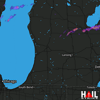 GRAND RAPIDS (KGRR) RADAR
States Impacted By Hail On May 17, 2026
Michigan
·
Wisconsin
Counties Impacted By Hail On May 17, 2026
Bay, MI
·
Grand Traverse, MI
·
Gratiot, MI
·
Huron, MI
·
Isabella, MI
·
Kalkaska, MI
·
Manistee, MI
·
Midland, MI
·
Montcalm, MI
·
Osceola, MI
·
Saginaw, MI
·
Sanilac, MI
·
Tuscola, MI
·
Kewaunee, WI
·
Manitowoc, WI
·
Sheboygan, WI
Cities Impacted By Hail On May 17, 2026
Akron, MI
·
Alma, MI
·
Bay City, MI
·
Breckenridge, MI
·
Cass City, MI
·
Cleveland, WI
·
Edmore, MI
·
Elkhart Lake, WI
·
Essexville, MI
·
Fairgrove, MI
·
Freeland, MI
·
Gagetown, MI
·
Glenbeulah, WI
·
Hemlock, MI
·
Howards Grove, WI
·
Midland, MI
·
Mount Pleasant, MI
·
Plymouth, WI
·
Ubly, MI
·
Unionville, MI
·
Whitelaw, WI
·
Zilwaukee, MI
Zip Codes Impacted By Hail On May 17, 2026
54247
·
53063
·
48710
·
48626
·
54241
·
54230
·
54228
·
54220
·
54216
·
54208
·
53085
·
53083
·
53073
·
53023
·
53020
·
53015
·
53011
·
49680
·
49675
·
49665
·
49655
·
49633
·
49631
·
49614
·
49329
·
49310
·
48896
·
48891
·
48889
·
48888
·
48883
·
48880
·
48877
·
48858
·
48852
·
48832
·
48829
·
48801
·
48768
·
48767
·
48759
·
48757
·
48754
·
48747
·
48735
·
48733
·
48732
·
48726
·
48723
·
48708
·
48706
·
48701
·
48667
·
48662
·
48640
·
48637
·
48623
·
48615
·
48611
·
48604
·
48603
·
48601
·
48475
·
48472
·
48456
·
48427
·
48413

