This weather event on May 17, 2026 includes:
3 states
22 counties,
19 cities,
and 67 zip codes.
There were 287 total properties that were impacted and have possible damage.
States Impacted By Hail On May 17, 2026
Iowa
·
Missouri
·
Wisconsin
Counties Impacted By Hail On May 17, 2026
Appanoose, IA
·
Benton, IA
·
Cedar, IA
·
Davis, IA
·
Iowa, IA
·
Johnson, IA
·
Keokuk, IA
·
Lucas, IA
·
Mahaska, IA
·
Marion, IA
·
Monroe, IA
·
Poweshiek, IA
·
Van Buren, IA
·
Wapello, IA
·
Washington, IA
·
Wayne, IA
·
Schuyler, MO
·
Columbia, WI
·
Dane, WI
·
Dodge, WI
·
Richland, WI
·
Sauk, WI
Cities Impacted By Hail On May 17, 2026
Arlington, WI
·
Centerville, IA
·
Columbus, WI
·
Doylestown, WI
·
Fall River, WI
·
Lake Wisconsin, WI
·
Leighton, IA
·
Lime Ridge, WI
·
Marengo, IA
·
Marysville, IA
·
Melrose, IA
·
Mystic, IA
·
Oskaloosa, IA
·
Ottumwa, IA
·
Poynette, WI
·
Rathbun, IA
·
Rio, WI
·
Riverside, IA
·
Thornburg, IA
Zip Codes Impacted By Hail On May 17, 2026
52594
·
50219
·
50044
·
63535
·
53961
·
53960
·
53959
·
53955
·
53943
·
53941
·
53937
·
53932
·
53928
·
53925
·
53924
·
53911
·
53590
·
53581
·
53578
·
53561
·
53559
·
53555
·
52776
·
52651
·
52593
·
52591
·
52586
·
52583
·
52581
·
52577
·
52574
·
52572
·
52571
·
52569
·
52561
·
52555
·
52553
·
52552
·
52550
·
52544
·
52543
·
52537
·
52536
·
52535
·
52531
·
52501
·
52361
·
52358
·
52354
·
52338
·
52333
·
52327
·
52315
·
52301
·
52222
·
52221
·
50268
·
50256
·
50255
·
50238
·
50207
·
50150
·
50143
·
50138
·
50136
·
50116
·
50057
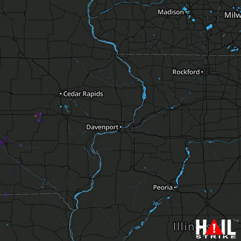 DAVENPORT (KDVN) RADAR

