This weather event on May 16, 2026 includes:
1 states
16 counties,
24 cities,
and 55 zip codes.
There were 2192 total properties that were impacted and have possible damage.
States Impacted By Hail On May 16, 2026
Florida
Counties Impacted By Hail On May 16, 2026
Broward, FL
·
Charlotte, FL
·
Citrus, FL
·
Collier, FL
·
DeSoto, FL
·
Gilchrist, FL
·
Glades, FL
·
Hardee, FL
·
Hendry, FL
·
Hernando, FL
·
Highlands, FL
·
Levy, FL
·
Marion, FL
·
Pasco, FL
·
Polk, FL
·
Sumter, FL
Cities Impacted By Hail On May 16, 2026
Bell, FL
·
Bronson, FL
·
Bushnell, FL
·
Center Hill, FL
·
Coleman, FL
·
East Bronson, FL
·
Fort Denaud, FL
·
Hernando, FL
·
Inverness, FL
·
Inverness Highlands South, FL
·
LaBelle, FL
·
Lacoochee, FL
·
Lakeland, FL
·
Lake Panasoffkee, FL
·
Ocala, FL
·
Port LaBelle, FL
·
Ridge Manor, FL
·
The Villages, FL
·
Trenton, FL
·
Wildwood, FL
·
Williston, FL
·
Williston Highlands, FL
·
Zephyrhills, FL
·
Zephyrhills North, FL
Zip Codes Impacted By Hail On May 16, 2026
34785
·
34602
·
34491
·
34484
·
34482
·
34481
·
34476
·
34474
·
34473
·
34453
·
34452
·
34450
·
34442
·
34436
·
34434
·
34432
·
34266
·
34142
·
34141
·
33982
·
33960
·
33944
·
33935
·
33930
·
33890
·
33873
·
33868
·
33852
·
33849
·
33823
·
33810
·
33809
·
33805
·
33597
·
33585
·
33542
·
33540
·
33538
·
33525
·
33523
·
33521
·
33514
·
33513
·
33471
·
33440
·
32696
·
32693
·
32669
·
32668
·
32643
·
32626
·
32621
·
32619
·
32618
·
32162
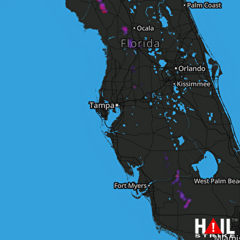 TAMPA (KTBW) RADAR

