This weather event on May 16, 2026 includes:
3 states
17 counties,
15 cities,
and 57 zip codes.
There were 1419 total properties that were impacted and have possible damage.
States Impacted By Hail On May 16, 2026
Illinois
·
Indiana
·
Kentucky
Counties Impacted By Hail On May 16, 2026
Champaign, IL
·
Edgar, IL
·
Logan, IL
·
Macon, IL
·
Piatt, IL
·
Sangamon, IL
·
Vermilion, IL
·
Clark, IN
·
Floyd, IN
·
Harrison, IN
·
Orange, IN
·
Parke, IN
·
Putnam, IN
·
Vermillion, IN
·
Washington, IN
·
Henry, KY
·
Oldham, KY
Cities Impacted By Hail On May 16, 2026
Borden, IN
·
Buckner, KY
·
Charlestown, IN
·
Crestwood, KY
·
Decatur, IL
·
Fairmount, IL
·
Fredericksburg, IN
·
La Grange, KY
·
Long Creek, IL
·
New Pekin, IN
·
Palmyra, IN
·
Sadorus, IL
·
Sellersburg, IN
·
St. Bernice, IN
·
Van Bibber Lake, IN
Zip Codes Impacted By Hail On May 16, 2026
47115
·
47111
·
62573
·
62554
·
62549
·
62548
·
62535
·
62526
·
62521
·
62519
·
62515
·
62501
·
61944
·
61940
·
61924
·
61880
·
61877
·
61873
·
61872
·
61859
·
61849
·
61841
·
61818
·
61817
·
61756
·
47872
·
47862
·
47854
·
47847
·
47842
·
47454
·
47432
·
47172
·
47167
·
47165
·
47164
·
47163
·
47143
·
47141
·
47140
·
47125
·
47120
·
47119
·
47118
·
47106
·
46172
·
46135
·
40070
·
40068
·
40059
·
40055
·
40050
·
40031
·
40026
·
40019
·
40014
·
40010
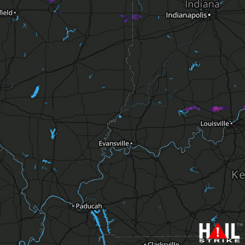 EVANSVILLE (KVWX) RADAR

