This weather event on May 16, 2026 includes:
1 states
22 counties,
24 cities,
and 81 zip codes.
There were 1962 total properties that were impacted and have possible damage.
States Impacted By Hail On May 16, 2026
Missouri
Counties Impacted By Hail On May 16, 2026
Adair, MO
·
Audrain, MO
·
Boone, MO
·
Callaway, MO
·
Chariton, MO
·
Cole, MO
·
Cooper, MO
·
Daviess, MO
·
DeKalb, MO
·
Grundy, MO
·
Howard, MO
·
Knox, MO
·
Linn, MO
·
Livingston, MO
·
Macon, MO
·
Maries, MO
·
Moniteau, MO
·
Osage, MO
·
Phelps, MO
·
Saline, MO
·
Shelby, MO
·
Sullivan, MO
Cities Impacted By Hail On May 16, 2026
Arrow Rock, MO
·
Bethel, MO
·
Blackwater, MO
·
Brookfield, MO
·
Chillicothe, MO
·
Chula, MO
·
Dawn, MO
·
Ethel, MO
·
Gallatin, MO
·
Gilliam, MO
·
Jameson, MO
·
Jamesport, MO
·
Lake Viking, MO
·
Leonard, MO
·
Linneus, MO
·
Lock Springs, MO
·
Lohman, MO
·
Nelson, MO
·
Purdin, MO
·
Rothville, MO
·
Slater, MO
·
St. Martins, MO
·
Utica, MO
·
Winigan, MO
Zip Codes Impacted By Hail On May 16, 2026
65347
·
64660
·
64647
·
65550
·
65459
·
65349
·
65340
·
65339
·
65330
·
65322
·
65320
·
65284
·
65281
·
65261
·
65254
·
65251
·
65250
·
65248
·
65246
·
65240
·
65236
·
65109
·
65085
·
65080
·
65077
·
65076
·
65074
·
65059
·
65053
·
65051
·
65035
·
65024
·
65013
·
64689
·
64688
·
64686
·
64683
·
64681
·
64676
·
64674
·
64670
·
64664
·
64659
·
64658
·
64656
·
64654
·
64653
·
64651
·
64648
·
64646
·
64643
·
64640
·
64638
·
64636
·
64635
·
64631
·
64630
·
64628
·
64625
·
64601
·
64497
·
63566
·
63558
·
63557
·
63556
·
63549
·
63547
·
63540
·
63539
·
63538
·
63537
·
63534
·
63530
·
63469
·
63460
·
63458
·
63451
·
63443
·
63439
·
63437
·
63434
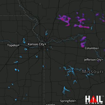 KANSAS CITY (KEAX) RADAR

