This weather event on May 16, 2026 includes:
1 states
17 counties,
30 cities,
and 85 zip codes.
There were 17911 total properties that were impacted and have possible damage.
States Impacted By Hail On May 16, 2026
Michigan
Counties Impacted By Hail On May 16, 2026
Calhoun, MI
·
Clinton, MI
·
Eaton, MI
·
Genesee, MI
·
Ingham, MI
·
Ionia, MI
·
Jackson, MI
·
Kent, MI
·
Lapeer, MI
·
Livingston, MI
·
Macomb, MI
·
Oakland, MI
·
Shiawassee, MI
·
St. Clair, MI
·
Tuscola, MI
·
Washtenaw, MI
·
Wayne, MI
Cities Impacted By Hail On May 16, 2026
Albion, MI
·
Argentine, MI
·
Auburn Hills, MI
·
Bath, MI
·
DeWitt, MI
·
Fowler, MI
·
Haslett, MI
·
Ionia, MI
·
Keego Harbor, MI
·
Laingsburg, MI
·
Lake Angelus, MI
·
Livonia, MI
·
Lowell, MI
·
Lyons, MI
·
Morrice, MI
·
Okemos, MI
·
Orchard Lake Village, MI
·
Perry, MI
·
Pewamo, MI
·
Pontiac, MI
·
Portland, MI
·
Rochester Hills, MI
·
Southfield, MI
·
Sterling Heights, MI
·
Sylvan Lake, MI
·
Troy, MI
·
Utica, MI
·
Vandercook Lake, MI
·
Village of Clarkston, MI
·
Westphalia, MI
Zip Codes Impacted By Hail On May 16, 2026
49331
·
49277
·
49269
·
49224
·
49203
·
49201
·
48895
·
48894
·
48892
·
48881
·
48879
·
48875
·
48873
·
48872
·
48866
·
48865
·
48864
·
48860
·
48857
·
48855
·
48851
·
48848
·
48846
·
48840
·
48836
·
48835
·
48827
·
48823
·
48822
·
48820
·
48819
·
48816
·
48809
·
48808
·
48744
·
48461
·
48451
·
48442
·
48435
·
48430
·
48418
·
48414
·
48386
·
48383
·
48360
·
48359
·
48357
·
48356
·
48353
·
48350
·
48348
·
48346
·
48342
·
48341
·
48340
·
48329
·
48328
·
48327
·
48326
·
48324
·
48323
·
48320
·
48317
·
48314
·
48313
·
48312
·
48310
·
48309
·
48307
·
48304
·
48302
·
48301
·
48240
·
48170
·
48169
·
48168
·
48154
·
48152
·
48137
·
48130
·
48098
·
48085
·
48083
·
48033
·
48028
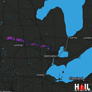 DETROIT (KDTX) RADAR

