This weather event on May 15, 2026 includes:
2 states
14 counties,
27 cities,
and 60 zip codes.
There were 841 total properties that were impacted and have possible damage.
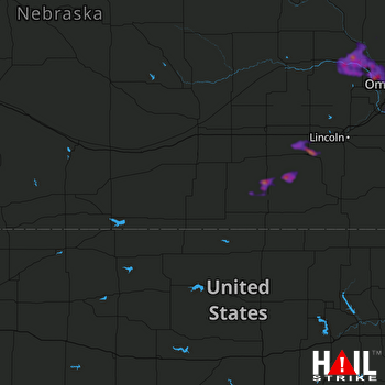 HASTINGS (KUEX) RADAR
States Impacted By Hail On May 15, 2026
Iowa
·
Nebraska
Counties Impacted By Hail On May 15, 2026
Fremont, IA
·
Mills, IA
·
Burt, NE
·
Cass, NE
·
Dodge, NE
·
Douglas, NE
·
Fillmore, NE
·
Otoe, NE
·
Saline, NE
·
Sarpy, NE
·
Saunders, NE
·
Seward, NE
·
Thayer, NE
·
Washington, NE
Cities Impacted By Hail On May 15, 2026
Ames, NE
·
Arlington, NE
·
Bartlett, IA
·
Carleton, NE
·
Cedar Bluffs, NE
·
Davenport, NE
·
Fremont, NE
·
Hooper, NE
·
Inglewood, NE
·
Kennard, NE
·
King Lake, NE
·
Leshara, NE
·
Milford, NE
·
Milligan, NE
·
Morse Bluff, NE
·
Murray, NE
·
North Bend, NE
·
Omaha, NE
·
Percival, IA
·
Plattsmouth, NE
·
Strang, NE
·
Thurman, IA
·
Tobias, NE
·
Union, NE
·
Valley, NE
·
Waterloo, NE
·
Winslow, NE
Zip Codes Impacted By Hail On May 15, 2026
68649
·
68648
·
68621
·
68464
·
68463
·
68455
·
68453
·
68444
·
68436
·
68434
·
68416
·
68413
·
68410
·
68409
·
68407
·
68406
·
68405
·
68361
·
68359
·
68349
·
68346
·
68343
·
68335
·
68333
·
68326
·
68322
·
68313
·
68307
·
68142
·
68122
·
68118
·
68116
·
68073
·
68072
·
68069
·
68064
·
68059
·
68058
·
68050
·
68048
·
68044
·
68041
·
68040
·
68037
·
68034
·
68031
·
68029
·
68028
·
68025
·
68023
·
68022
·
68018
·
68015
·
68008
·
68007
·
68003
·
68002
·
51654
·
51648
·
51561

