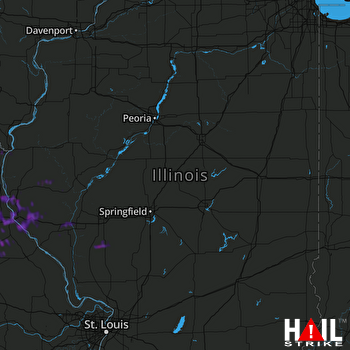
This weather event on May 15, 2026 includes:
3 states
21 counties,
32 cities,
and 82 zip codes.
There were 926 total properties that were impacted and have possible damage.
States Impacted By Hail On May 15, 2026
Iowa
·
Illinois
·
Missouri
Counties Impacted By Hail On May 15, 2026
Lee, IA
·
Adams, IL
·
Brown, IL
·
Calhoun, IL
·
Champaign, IL
·
Greene, IL
·
Hancock, IL
·
Logan, IL
·
Macoupin, IL
·
Montgomery, IL
·
Morgan, IL
·
Pike, IL
·
Schuyler, IL
·
Scott, IL
·
Clark, MO
·
Lewis, MO
·
Marion, MO
·
Monroe, MO
·
Pike, MO
·
Ralls, MO
·
Shelby, MO
Cities Impacted By Hail On May 15, 2026
Alexandria, MO
·
Barry, IL
·
Center, MO
·
Florence, IL
·
Florida, MO
·
Golden, IL
·
Griggsville, IL
·
Hamilton, IL
·
Hannibal, MO
·
Hull, IL
·
Keokuk, IA
·
Kinderhook, IL
·
La Prairie, IL
·
Lincoln, IL
·
Litchfield, IL
·
Monroe City, MO
·
Montrose, IA
·
New Canton, IL
·
Palmyra, MO
·
Payson, IL
·
Perry, MO
·
Pittsfield, IL
·
Plainville, IL
·
Quincy, IL
·
Rensselaer, MO
·
Roodhouse, IL
·
Scottville, IL
·
St. Francisville, MO
·
Valley City, IL
·
Warsaw, IL
·
Wayland, MO
·
Wilmington, IL
Zip Codes Impacted By Hail On May 15, 2026
62360
·
63463
·
65283
·
65282
·
65275
·
63473
·
63472
·
63471
·
63467
·
63465
·
63462
·
63461
·
63459
·
63457
·
63456
·
63454
·
63452
·
63448
·
63445
·
63443
·
63441
·
63439
·
63436
·
63435
·
63430
·
63401
·
63382
·
62694
·
62674
·
62668
·
62667
·
62666
·
62665
·
62656
·
62649
·
62640
·
62626
·
62621
·
62380
·
62379
·
62376
·
62375
·
62367
·
62365
·
62363
·
62361
·
62357
·
62356
·
62353
·
62351
·
62349
·
62347
·
62346
·
62345
·
62344
·
62343
·
62340
·
62339
·
62338
·
62324
·
62321
·
62320
·
62314
·
62312
·
62305
·
62301
·
62092
·
62082
·
62078
·
62056
·
62053
·
62049
·
62033
·
62032
·
62027
·
62017
·
62016
·
62015
·
61853
·
52639
·
52632
·
52619
 LINCOLN (KILX) RADAR

