This weather event on May 10, 2026 includes:
1 states
29 counties,
19 cities,
and 63 zip codes.
There were 10757 total properties that were impacted and have possible damage.
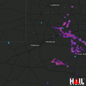 MIDLAND/ODSSA (KMAF) RADAR
States Impacted By Hail On May 10, 2026
Texas
Counties Impacted By Hail On May 10, 2026
Borden, TX
·
Brewster, TX
·
Coke, TX
·
Concho, TX
·
Crockett, TX
·
Crosby, TX
·
Dawson, TX
·
Dickens, TX
·
Fisher, TX
·
Garza, TX
·
Howard, TX
·
Irion, TX
·
Kent, TX
·
King, TX
·
Menard, TX
·
Mitchell, TX
·
Nolan, TX
·
Pecos, TX
·
Reagan, TX
·
Runnels, TX
·
Schleicher, TX
·
Scurry, TX
·
Sterling, TX
·
Stonewall, TX
·
Sutton, TX
·
Terrell, TX
·
Tom Green, TX
·
Upton, TX
·
Val Verde, TX
Cities Impacted By Hail On May 10, 2026
Aspermont, TX
·
Big Lake, TX
·
Blackwell, TX
·
Carlsbad, TX
·
Christoval, TX
·
Coahoma, TX
·
Colorado City, TX
·
Grape Creek, TX
·
Iraan, TX
·
Lake Colorado City, TX
·
Loraine, TX
·
Mertzon, TX
·
Miles, TX
·
Robert Lee, TX
·
San Angelo, TX
·
Sand Springs, TX
·
Snyder, TX
·
Westbrook, TX
·
Winters, TX
Zip Codes Impacted By Hail On May 10, 2026
79518
·
76882
·
76821
·
79848
·
79744
·
79738
·
79720
·
79713
·
79567
·
79566
·
79565
·
79556
·
79549
·
79546
·
79545
·
79535
·
79532
·
79528
·
79527
·
79526
·
79517
·
79512
·
79511
·
79506
·
79502
·
79370
·
79331
·
79330
·
79322
·
79243
·
79236
·
79235
·
79229
·
79220
·
78871
·
78851
·
76958
·
76953
·
76951
·
76950
·
76949
·
76945
·
76943
·
76941
·
76939
·
76936
·
76935
·
76934
·
76933
·
76932
·
76930
·
76908
·
76905
·
76904
·
76903
·
76901
·
76875
·
76866
·
76865
·
76861
·
76859
·
76841
·
76837

