This weather event on May 8, 2026 includes:
4 states
23 counties,
32 cities,
and 61 zip codes.
There were 7641 total properties that were impacted and have possible damage.
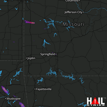 SPRINGFIELD (KSGF) RADAR
States Impacted By Hail On May 8, 2026
Arkansas
·
Kansas
·
Missouri
·
Oklahoma
Counties Impacted By Hail On May 8, 2026
Crawford, AR
·
Franklin, AR
·
Sebastian, AR
·
Crawford, KS
·
Linn, KS
·
Neosho, KS
·
Barton, MO
·
Bates, MO
·
Cass, MO
·
Cedar, MO
·
Dade, MO
·
Greene, MO
·
Polk, MO
·
St. Clair, MO
·
Vernon, MO
·
Adair, OK
·
Cherokee, OK
·
Le Flore, OK
·
Mayes, OK
·
Muskogee, OK
·
Rogers, OK
·
Sequoyah, OK
·
Wagoner, OK
Cities Impacted By Hail On May 8, 2026
Akins, OK
·
Barling, AR
·
Brushy, OK
·
Butler, MO
·
Central City, AR
·
Dry Creek, OK
·
Evening Shade, OK
·
Flute Springs, OK
·
Fort Gibson, OK
·
Fort Smith, AR
·
Garden City, MO
·
Gregory, OK
·
Inola, OK
·
Keys, OK
·
Kibler, AR
·
Lavaca, AR
·
Liberty, OK
·
Long, OK
·
Marble City, OK
·
Moffett, OK
·
Muldrow, OK
·
Muskogee, OK
·
Osceola, MO
·
Park Hill, OK
·
Remy, OK
·
Roland, OK
·
Springfield, MO
·
Stoney Point, OK
·
Wagoner, OK
·
Willard, MO
·
Woodall, OK
·
Zeb, OK
Zip Codes Impacted By Hail On May 8, 2026
65674
·
74477
·
74962
·
74955
·
74954
·
74948
·
74946
·
74945
·
74931
·
74901
·
74467
·
74464
·
74451
·
74441
·
74434
·
74427
·
74352
·
74337
·
74036
·
72956
·
72941
·
72933
·
72923
·
72921
·
72916
·
72908
·
72904
·
72903
·
72901
·
66780
·
66746
·
66743
·
66734
·
66733
·
66711
·
66075
·
66040
·
65809
·
65807
·
65806
·
65804
·
65803
·
65802
·
65781
·
65742
·
65682
·
65661
·
65646
·
65604
·
64784
·
64776
·
64767
·
64763
·
64759
·
64747
·
64744
·
64730
·
64723
·
64722
·
64720
·
64701

