This weather event on May 6, 2026 includes:
2 states
22 counties,
18 cities,
and 71 zip codes.
There were 568 total properties that were impacted and have possible damage.
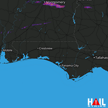 EGLIN AFB (KEVX) RADAR
States Impacted By Hail On May 6, 2026
Alabama
·
Georgia
Counties Impacted By Hail On May 6, 2026
Autauga, AL
·
Baldwin, AL
·
Bullock, AL
·
Butler, AL
·
Clarke, AL
·
Conecuh, AL
·
Crenshaw, AL
·
Dallas, AL
·
Elmore, AL
·
Lowndes, AL
·
Macon, AL
·
Monroe, AL
·
Montgomery, AL
·
Pike, AL
·
Russell, AL
·
Washington, AL
·
Chattahoochee, GA
·
Marion, GA
·
Schley, GA
·
Stewart, GA
·
Sumter, GA
·
Webster, GA
Cities Impacted By Hail On May 6, 2026
Carlton, AL
·
Cusseta-Chattahoochee County, GA
·
Excel, AL
·
Frisco City, AL
·
Georgiana, AL
·
Glenwood, AL
·
Luverne, AL
·
McKenzie, AL
·
Monroeville, AL
·
Montgomery, AL
·
Pike Road, AL
·
Prattville, AL
·
Selma, AL
·
Selmont-West Selmont, AL
·
Shorter, AL
·
Tuskegee, AL
·
Webster County, GA
·
White Hall, AL
Zip Codes Impacted By Hail On May 6, 2026
36009
·
31719
·
36875
·
36871
·
36860
·
36858
·
36785
·
36752
·
36703
·
36701
·
36585
·
36583
·
36581
·
36553
·
36550
·
36545
·
36529
·
36481
·
36480
·
36475
·
36474
·
36471
·
36460
·
36456
·
36445
·
36439
·
36432
·
36425
·
36401
·
36117
·
36116
·
36111
·
36109
·
36108
·
36107
·
36106
·
36105
·
36104
·
36089
·
36088
·
36083
·
36079
·
36078
·
36075
·
36071
·
36067
·
36064
·
36053
·
36052
·
36049
·
36046
·
36043
·
36042
·
36041
·
36040
·
36039
·
36037
·
36035
·
36034
·
36033
·
36031
·
36029
·
36013
·
36010
·
36003
·
31825
·
31824
·
31806
·
31805
·
31803
·
31780

