This weather event on May 6, 2026 includes:
3 states
20 counties,
27 cities,
and 56 zip codes.
There were total properties that were impacted and have possible damage.
States Impacted By Hail On May 6, 2026
Arkansas
·
Mississippi
·
Tennessee
Counties Impacted By Hail On May 6, 2026
Crittenden, AR
·
Lee, AR
·
St. Francis, AR
·
Benton, MS
·
DeSoto, MS
·
Marshall, MS
·
Tippah, MS
·
Tunica, MS
·
Chester, TN
·
Crockett, TN
·
Fayette, TN
·
Gibson, TN
·
Hardeman, TN
·
Hardin, TN
·
Haywood, TN
·
Lauderdale, TN
·
Madison, TN
·
McNairy, TN
·
Shelby, TN
·
Tipton, TN
Cities Impacted By Hail On May 6, 2026
Adamsville, TN
·
Arlington, TN
·
Ashland, MS
·
Atoka, TN
·
Bethel Springs, TN
·
Bolivar, TN
·
Braden, TN
·
Collierville, TN
·
Crump, TN
·
Gallaway, TN
·
Hornsby, TN
·
Hughes, AR
·
Lakeland, TN
·
Mason, TN
·
Maury City, TN
·
Memphis, TN
·
Millington, TN
·
Munford, TN
·
Olive Branch, MS
·
Olivet, TN
·
Piperton, TN
·
Rossville, TN
·
Savannah, TN
·
Selmer, TN
·
Snow Lake Shores, MS
·
Walls, MS
·
Whiteville, TN
Zip Codes Impacted By Hail On May 6, 2026
38301
·
38375
·
72360
·
72348
·
72320
·
38680
·
38674
·
38664
·
38654
·
38647
·
38642
·
38641
·
38635
·
38629
·
38611
·
38603
·
38392
·
38391
·
38382
·
38381
·
38372
·
38343
·
38340
·
38334
·
38327
·
38315
·
38310
·
38127
·
38109
·
38075
·
38069
·
38068
·
38066
·
38063
·
38058
·
38057
·
38054
·
38053
·
38050
·
38049
·
38044
·
38040
·
38037
·
38036
·
38034
·
38023
·
38021
·
38019
·
38017
·
38012
·
38011
·
38008
·
38006
·
38004
·
38002
·
38001
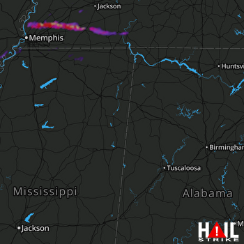 COLUMBUS AFB (KGWX) RADAR

