This weather event on April 30, 2026 includes:
3 states
20 counties,
27 cities,
and 76 zip codes.
There were 5690 total properties that were impacted and have possible damage.
States Impacted By Hail On April 30, 2026
Louisiana
·
Mississippi
·
Texas
Counties Impacted By Hail On April 30, 2026
Catahoula, LA
·
Concordia, LA
·
De Soto, LA
·
Grant, LA
·
LaSalle, LA
·
Natchitoches, LA
·
Rapides, LA
·
Red River, LA
·
Sabine, LA
·
Tensas, LA
·
Vernon, LA
·
Winn, LA
·
Adams, MS
·
Cherokee, TX
·
Nacogdoches, TX
·
Panola, TX
·
Rusk, TX
·
Sabine, TX
·
San Augustine, TX
·
Shelby, TX
Cities Impacted By Hail On April 30, 2026
Anacoco, LA
·
Appleby, TX
·
Belmont, LA
·
Clayton, LA
·
Colfax, LA
·
Dry Prong, LA
·
Forest Hill, LA
·
Fort Polk North, LA
·
Gary City, TX
·
Harrisonburg, LA
·
Jena, LA
·
Keachi, LA
·
Longstreet, LA
·
Mansfield, LA
·
Midway, LA
·
Milam, TX
·
Morgantown, MS
·
Mount Enterprise, TX
·
Nacogdoches, TX
·
Natchez, MS
·
Natchitoches, LA
·
New Summerfield, TX
·
Redfield, TX
·
Rusk, TX
·
San Augustine, TX
·
Wallace Ridge, LA
·
Zwolle, LA
Zip Codes Impacted By Hail On April 30, 2026
75975
·
75943
·
71430
·
71403
·
39120
·
75974
·
75972
·
75965
·
75964
·
75961
·
75959
·
75954
·
75948
·
75946
·
75935
·
75930
·
75925
·
75789
·
75788
·
75785
·
75784
·
75780
·
75766
·
75760
·
75681
·
75669
·
75667
·
75654
·
75643
·
75633
·
71486
·
71485
·
71483
·
71469
·
71468
·
71467
·
71465
·
71462
·
71457
·
71456
·
71455
·
71452
·
71450
·
71449
·
71447
·
71446
·
71439
·
71438
·
71433
·
71432
·
71429
·
71423
·
71417
·
71416
·
71407
·
71406
·
71404
·
71401
·
71375
·
71371
·
71368
·
71366
·
71343
·
71342
·
71340
·
71334
·
71326
·
71115
·
71052
·
71049
·
71046
·
71032
·
71030
·
71027
·
71019
·
70656
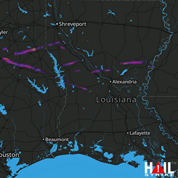 FORT POLK (KPOE) RADAR

