This weather event on April 28, 2026 includes:
2 states
21 counties,
17 cities,
and 53 zip codes.
There were 2189 total properties that were impacted and have possible damage.
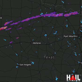 ABILENE (KDYX) RADAR
States Impacted By Hail On April 28, 2026
Oklahoma
·
Texas
Counties Impacted By Hail On April 28, 2026
Jefferson, OK
·
Love, OK
·
Archer, TX
·
Baylor, TX
·
Clay, TX
·
Cooke, TX
·
Crosby, TX
·
Dickens, TX
·
Fisher, TX
·
Garza, TX
·
Haskell, TX
·
Kent, TX
·
King, TX
·
Knox, TX
·
Lynn, TX
·
Mitchell, TX
·
Montague, TX
·
Scurry, TX
·
Stonewall, TX
·
Wichita, TX
·
Wilbarger, TX
Cities Impacted By Hail On April 28, 2026
Aspermont, TX
·
Benjamin, TX
·
Girard, TX
·
Henrietta, TX
·
Holliday, TX
·
Lakeside City, TX
·
Montague, TX
·
Nocona, TX
·
Nocona Hills, TX
·
Post, TX
·
Rochester, TX
·
Scotland, TX
·
Seymour, TX
·
Spur, TX
·
St. Jo, TX
·
Terral, OK
·
Wichita Falls, TX
Zip Codes Impacted By Hail On April 28, 2026
79556
·
79549
·
79547
·
79546
·
79545
·
79544
·
79543
·
79540
·
79539
·
79532
·
79529
·
79528
·
79526
·
79518
·
79512
·
79505
·
79502
·
79373
·
79370
·
79356
·
79330
·
79236
·
79227
·
76389
·
76388
·
76380
·
76379
·
76371
·
76370
·
76367
·
76366
·
76365
·
76364
·
76363
·
76360
·
76351
·
76310
·
76309
·
76308
·
76302
·
76301
·
76265
·
76261
·
76255
·
76252
·
76251
·
76240
·
76230
·
76228
·
73573
·
73569
·
73456
·
73430

