This weather event on April 27, 2026 includes:
2 states
16 counties,
20 cities,
and 61 zip codes.
There were 552 total properties that were impacted and have possible damage.
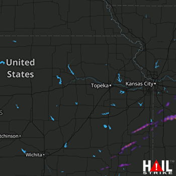 TOPEKA (KTWX) RADAR
States Impacted By Hail On April 27, 2026
Kansas
·
Missouri
Counties Impacted By Hail On April 27, 2026
Allen, KS
·
Anderson, KS
·
Bourbon, KS
·
Linn, KS
·
Marshall, KS
·
Miami, KS
·
Nemaha, KS
·
Neosho, KS
·
Wilson, KS
·
Woodson, KS
·
Bates, MO
·
Cass, MO
·
Henry, MO
·
Johnson, MO
·
Lafayette, MO
·
Vernon, MO
Cities Impacted By Hail On April 27, 2026
Adrian, MO
·
Blairstown, MO
·
Chanute, KS
·
Chilhowee, MO
·
East Lynne, MO
·
Elsmore, KS
·
Galesburg, KS
·
Harrisonville, MO
·
Hartwell, MO
·
Humboldt, KS
·
Hume, MO
·
Leeton, MO
·
Moran, KS
·
Neodesha, KS
·
Passaic, MO
·
Prescott, KS
·
St. Paul, KS
·
Thayer, KS
·
Uniontown, KS
·
Urich, MO
Zip Codes Impacted By Hail On April 27, 2026
64019
·
64020
·
64037
·
64040
·
64061
·
64071
·
64076
·
64080
·
64093
·
64701
·
64720
·
64722
·
64723
·
64725
·
64726
·
64730
·
64733
·
64735
·
64739
·
64742
·
64743
·
64746
·
64747
·
64752
·
64761
·
64779
·
64788
·
65336
·
65360
·
66010
·
66014
·
66039
·
66040
·
66056
·
66072
·
66075
·
66415
·
66544
·
66710
·
66714
·
66716
·
66717
·
66720
·
66732
·
66733
·
66736
·
66738
·
66740
·
66748
·
66749
·
66751
·
66754
·
66755
·
66757
·
66767
·
66769
·
66771
·
66772
·
66776
·
66779
·
66783

