This weather event on April 26, 2026 includes:
4 states
12 counties,
33 cities,
and 40 zip codes.
There were total properties that were impacted and have possible damage.
States Impacted By Hail On April 26, 2026
Arkansas
·
Kansas
·
Missouri
·
Oklahoma
Counties Impacted By Hail On April 26, 2026
Cleburne, AR
·
Cherokee, KS
·
Crawford, KS
·
Labette, KS
·
Barry, MO
·
Jasper, MO
·
Lawrence, MO
·
Newton, MO
·
Stone, MO
·
Osage, OK
·
Ottawa, OK
·
Washington, OK
Cities Impacted By Hail On April 26, 2026
Airport Drive, MO
·
Bartlesville, OK
·
Baxter Springs, KS
·
Brooklyn Heights, MO
·
Carl Junction, MO
·
Carterville, MO
·
Carthage, MO
·
Cliff Village, MO
·
Columbus, KS
·
Crane, MO
·
Diamond, MO
·
Duenweg, MO
·
Duquesne, MO
·
Fidelity, MO
·
Galena, KS
·
Galena, MO
·
Grand Falls Plaza, MO
·
Joplin, MO
·
Labette, KS
·
Loma Linda, MO
·
Lowell, KS
·
Oronogo, MO
·
Pierce City, MO
·
Redings Mill, MO
·
Ritchey, MO
·
Riverton, KS
·
Saginaw, MO
·
Sarcoxie, MO
·
Shoal Creek Drive, MO
·
Waco, MO
·
Webb City, MO
·
Wentworth, MO
·
West Mineral, KS
Zip Codes Impacted By Hail On April 26, 2026
74363
·
74056
·
74003
·
72543
·
72131
·
67357
·
67356
·
67336
·
66782
·
66781
·
66773
·
66770
·
66762
·
66753
·
66739
·
66728
·
66725
·
66724
·
66713
·
65769
·
65723
·
65708
·
65656
·
65633
·
65605
·
64873
·
64870
·
64866
·
64862
·
64859
·
64855
·
64844
·
64841
·
64840
·
64836
·
64835
·
64834
·
64832
·
64804
·
64801
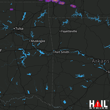 FORT SMITH (KSRX) RADAR

