This weather event on April 26, 2026 includes:
2 states
18 counties,
30 cities,
and 63 zip codes.
There were total properties that were impacted and have possible damage.
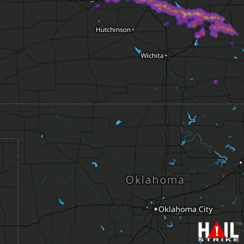 VANCE AFB (KVNX) RADAR
States Impacted By Hail On April 26, 2026
Kansas
·
Oklahoma
Counties Impacted By Hail On April 26, 2026
Barton, KS
·
Butler, KS
·
Chase, KS
·
Chautauqua, KS
·
Dickinson, KS
·
Elk, KS
·
Ellsworth, KS
·
Greenwood, KS
·
Harvey, KS
·
Lyon, KS
·
Marion, KS
·
McPherson, KS
·
Rice, KS
·
Rush, KS
·
Russell, KS
·
Saline, KS
·
Kay, OK
·
Osage, OK
Cities Impacted By Hail On April 26, 2026
Assaria, KS
·
Burns, KS
·
Bushton, KS
·
Canton, KS
·
Cassoday, KS
·
Cedar Point, KS
·
Claflin, KS
·
Ellinwood, KS
·
Elmdale, KS
·
Florence, KS
·
Frederick, KS
·
Galatia, KS
·
Galva, KS
·
Geneseo, KS
·
Grenola, KS
·
Hamilton, KS
·
Hesston, KS
·
Hillsboro, KS
·
Holyrood, KS
·
Lehigh, KS
·
Lindsborg, KS
·
Madison, KS
·
Marion, KS
·
Marquette, KS
·
McPherson, KS
·
Odin, KS
·
Olmitz, KS
·
Peabody, KS
·
Tampa, KS
·
Virgil, KS
Zip Codes Impacted By Hail On April 26, 2026
66850
·
67425
·
74652
·
74633
·
67665
·
67634
·
67575
·
67565
·
67564
·
67559
·
67556
·
67554
·
67548
·
67544
·
67530
·
67526
·
67525
·
67520
·
67513
·
67491
·
67490
·
67483
·
67475
·
67464
·
67460
·
67459
·
67457
·
67456
·
67454
·
67451
·
67450
·
67448
·
67444
·
67443
·
67439
·
67438
·
67428
·
67427
·
67416
·
67353
·
67346
·
67151
·
67132
·
67114
·
67073
·
67063
·
67062
·
67045
·
67042
·
66870
·
66866
·
66865
·
66863
·
66862
·
66861
·
66860
·
66853
·
66851
·
66845
·
66843
·
66842
·
66840
·
66777

