This weather event on April 25, 2026 includes:
2 states
25 counties,
23 cities,
and 64 zip codes.
There were 5911 total properties that were impacted and have possible damage.
States Impacted By Hail On April 25, 2026
North Carolina
·
Virginia
Counties Impacted By Hail On April 25, 2026
Bertie, NC
·
Durham, NC
·
Edgecombe, NC
·
Franklin, NC
·
Hertford, NC
·
Nash, NC
·
Tyrrell, NC
·
Wake, NC
·
Wilson, NC
·
Amelia, VA
·
Brunswick, VA
·
Charlotte, VA
·
Chesterfield, VA
·
Colonial Heights, VA
·
Dinwiddie, VA
·
Franklin, VA
·
Greensville, VA
·
Isle of Wight, VA
·
Lunenburg, VA
·
Nottoway, VA
·
Prince Edward, VA
·
Southampton, VA
·
Suffolk, VA
·
Surry, VA
·
Sussex, VA
Cities Impacted By Hail On April 25, 2026
Alberta, VA
·
Aulander, NC
·
Blackstone, VA
·
Camptown, VA
·
Capron, VA
·
Carrsville, VA
·
Colonial Heights, VA
·
Courtland, VA
·
Franklin, VA
·
Kenbridge, VA
·
Keysville, VA
·
Lake Royale, NC
·
Lunenburg, VA
·
Newsoms, VA
·
Nottoway Court House, VA
·
Rocky Mount, NC
·
Rolesville, NC
·
Suffolk, VA
·
Victoria, VA
·
Wakefield, VA
·
Wake Forest, NC
·
Warfield, VA
·
Waverly, VA
Zip Codes Impacted By Hail On April 25, 2026
23974
·
23821
·
23315
·
27986
·
27925
·
27924
·
27922
·
27910
·
27886
·
27882
·
27864
·
27856
·
27847
·
27822
·
27816
·
27809
·
27805
·
27803
·
27801
·
27703
·
27617
·
27613
·
27587
·
27571
·
27560
·
27549
·
23954
·
23952
·
23947
·
23944
·
23942
·
23938
·
23930
·
23923
·
23922
·
23898
·
23890
·
23889
·
23888
·
23882
·
23878
·
23876
·
23874
·
23872
·
23868
·
23867
·
23856
·
23851
·
23850
·
23847
·
23846
·
23844
·
23843
·
23841
·
23839
·
23838
·
23837
·
23834
·
23833
·
23829
·
23827
·
23824
·
23803
·
23437
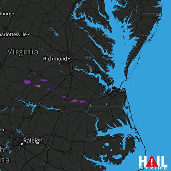 NORFOLK/RICH (KAKQ) RADAR

