This weather event on April 25, 2026 includes:
3 states
28 counties,
21 cities,
and 66 zip codes.
There were 3624 total properties that were impacted and have possible damage.
States Impacted By Hail On April 25, 2026
Louisiana
·
Mississippi
·
Texas
Counties Impacted By Hail On April 25, 2026
Acadia, LA
·
Assumption, LA
·
Avoyelles, LA
·
Calcasieu, LA
·
Catahoula, LA
·
Concordia, LA
·
East Feliciana, LA
·
Evangeline, LA
·
Grant, LA
·
Iberia, LA
·
Iberville, LA
·
Jefferson Davis, LA
·
Pointe Coupee, LA
·
Rapides, LA
·
Sabine, LA
·
St. Landry, LA
·
St. Martin, LA
·
Vermilion, LA
·
Vernon, LA
·
West Feliciana, LA
·
Winn, LA
·
Wilkinson, MS
·
Nacogdoches, TX
·
Panola, TX
·
Rusk, TX
·
Sabine, TX
·
San Augustine, TX
·
Shelby, TX
Cities Impacted By Hail On April 25, 2026
Anacoco, LA
·
Estherwood, LA
·
Fort Polk North, LA
·
Garrison, TX
·
Hornbeck, LA
·
Huxley, TX
·
Jennings, LA
·
Lake Charles, LA
·
Leesville, LA
·
Mermentau, LA
·
Milam, TX
·
Moss Bluff, LA
·
Norwood, LA
·
Pierre Part, LA
·
Plaquemine, LA
·
Roanoke, LA
·
San Augustine, TX
·
St. Gabriel, LA
·
Tenaha, TX
·
Timpson, TX
·
Welsh, LA
Zip Codes Impacted By Hail On April 25, 2026
75975
·
75974
·
75973
·
75972
·
75965
·
75959
·
75954
·
75948
·
75946
·
75935
·
75643
·
71462
·
71454
·
71449
·
71446
·
71439
·
71429
·
71423
·
71417
·
71409
·
71403
·
71373
·
71368
·
71362
·
71360
·
71355
·
71340
·
71339
·
71331
·
71327
·
71326
·
71303
·
70789
·
70788
·
70780
·
70776
·
70775
·
70764
·
70761
·
70759
·
70757
·
70750
·
70748
·
70732
·
70669
·
70656
·
70647
·
70615
·
70611
·
70601
·
70591
·
70582
·
70581
·
70559
·
70556
·
70546
·
70535
·
70534
·
70531
·
70526
·
70525
·
70517
·
70512
·
70339
·
39669
·
39631
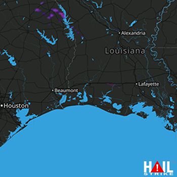 LAKE CHARLES (KLCH) RADAR

