This weather event on April 24, 2026 includes:
3 states
22 counties,
24 cities,
and 69 zip codes.
There were 259 total properties that were impacted and have possible damage.
States Impacted By Hail On April 24, 2026
Arkansas
·
Missouri
·
Oklahoma
Counties Impacted By Hail On April 24, 2026
Boone, AR
·
Crawford, AR
·
Faulkner, AR
·
Franklin, AR
·
Independence, AR
·
Izard, AR
·
Johnson, AR
·
Lawrence, AR
·
Logan, AR
·
Marion, AR
·
Newton, AR
·
Pulaski, AR
·
Scott, AR
·
Searcy, AR
·
Sebastian, AR
·
Sharp, AR
·
White, AR
·
Howell, MO
·
Oregon, MO
·
Ozark, MO
·
Adair, OK
·
Sequoyah, OK
Cities Impacted By Hail On April 24, 2026
Alma, AR
·
Altus, AR
·
Barling, AR
·
Caulksville, AR
·
Cedarville, AR
·
Denning, AR
·
Dyer, AR
·
Flippin, AR
·
Fort Smith, AR
·
Greenwood, AR
·
Jacksonville, AR
·
Kibler, AR
·
Lavaca, AR
·
Little Rock, AR
·
Melbourne, AR
·
Mulberry, AR
·
North Little Rock, AR
·
Oxford, AR
·
Pleasant Plains, AR
·
Rudy, AR
·
Sherwood, AR
·
Short, OK
·
Van Buren, AR
·
Wiederkehr Village, AR
Zip Codes Impacted By Hail On April 24, 2026
74960
·
74948
·
72958
·
72956
·
72955
·
72952
·
72951
·
72949
·
72948
·
72947
·
72946
·
72944
·
72941
·
72940
·
72936
·
72935
·
72934
·
72933
·
72932
·
72930
·
72928
·
72927
·
72923
·
72921
·
72916
·
72903
·
72855
·
72852
·
72830
·
72821
·
72634
·
72633
·
72628
·
72601
·
72585
·
72584
·
72579
·
72573
·
72569
·
72568
·
72565
·
72556
·
72536
·
72534
·
72532
·
72524
·
72521
·
72517
·
72501
·
72469
·
72466
·
72206
·
72205
·
72202
·
72201
·
72120
·
72118
·
72117
·
72116
·
72114
·
72081
·
72076
·
72032
·
72020
·
65790
·
65775
·
65655
·
65637
·
65606
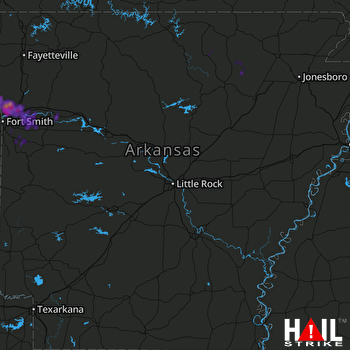 LITTLE ROCK (KLZK) RADAR

