This weather event on April 23, 2026 includes:
3 states
29 counties,
10 cities,
and 69 zip codes.
There were 22 total properties that were impacted and have possible damage.
States Impacted By Hail On April 23, 2026
Kansas
·
Missouri
·
Oklahoma
Counties Impacted By Hail On April 23, 2026
Allen, KS
·
Anderson, KS
·
Cherokee, KS
·
Franklin, KS
·
Linn, KS
·
Miami, KS
·
Wilson, KS
·
Woodson, KS
·
Barry, MO
·
Cedar, MO
·
Dallas, MO
·
Greene, MO
·
Howell, MO
·
Jasper, MO
·
Laclede, MO
·
Lawrence, MO
·
McDonald, MO
·
Newton, MO
·
Polk, MO
·
Texas, MO
·
Webster, MO
·
Wright, MO
·
Adair, OK
·
Cherokee, OK
·
Craig, OK
·
Muskogee, OK
·
Nowata, OK
·
Rogers, OK
·
Washington, OK
Cities Impacted By Hail On April 23, 2026
Chewey, OK
·
Coyville, KS
·
Harris, KS
·
Newtonia, MO
·
Springfield, MO
·
Stark City, MO
·
Stockton, MO
·
Umber View Heights, MO
·
Vera, OK
·
Westphalia, KS
Zip Codes Impacted By Hail On April 23, 2026
66725
·
66736
·
66748
·
66749
·
66751
·
66777
·
67047
·
74027
·
74042
·
74048
·
74369
·
74964
·
74434
·
74347
·
74301
·
74083
·
74080
·
74072
·
74061
·
74053
·
66717
·
66713
·
66093
·
66092
·
66091
·
66080
·
66079
·
66078
·
66071
·
66067
·
66056
·
66032
·
66021
·
65807
·
65802
·
65793
·
65785
·
65769
·
65756
·
65747
·
65738
·
65727
·
65723
·
65713
·
65712
·
65706
·
65704
·
65702
·
65663
·
65662
·
65644
·
65632
·
65625
·
65619
·
65613
·
65612
·
65605
·
65590
·
65536
·
64867
·
64866
·
64862
·
64861
·
64859
·
64856
·
64848
·
64844
·
64831
·
64756
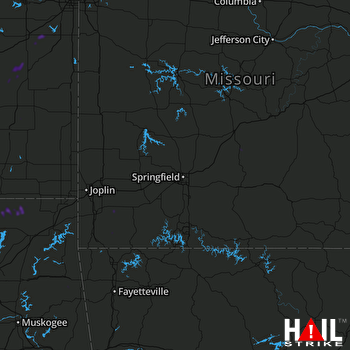 SPRINGFIELD (KSGF) RADAR

