This weather event on April 17, 2026 includes:
2 states
25 counties,
25 cities,
and 73 zip codes.
There were 3821 total properties that were impacted and have possible damage.
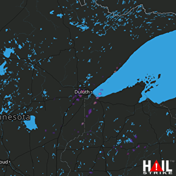 DULUTH (KDLH) RADAR
States Impacted By Hail On April 17, 2026
Minnesota
·
Wisconsin
Counties Impacted By Hail On April 17, 2026
Aitkin, MN
·
Carlton, MN
·
Chisago, MN
·
Crow Wing, MN
·
Kanabec, MN
·
Lake, MN
·
Pine, MN
·
St. Louis, MN
·
Washington, MN
·
Ashland, WI
·
Barron, WI
·
Bayfield, WI
·
Burnett, WI
·
Chippewa, WI
·
Clark, WI
·
Douglas, WI
·
Iron, WI
·
Oneida, WI
·
Polk, WI
·
Price, WI
·
Rusk, WI
·
Sawyer, WI
·
St. Croix, WI
·
Taylor, WI
·
Washburn, WI
Cities Impacted By Hail On April 17, 2026
Amery, WI
·
Barronett, WI
·
Brule, WI
·
Carlton, MN
·
Chief Lake, WI
·
Clayton, WI
·
Cloquet, MN
·
Deerwood, MN
·
Duluth, MN
·
Esko, MN
·
Finlayson, MN
·
Hermantown, MN
·
Lublin, WI
·
Mahtowa, MN
·
New Post, WI
·
Reserve, WI
·
Rice Lake, MN
·
Scandia, MN
·
Scanlon, MN
·
Shell Lake, WI
·
Stanley, WI
·
Stone Lake, WI
·
Superior, WI
·
Turtle Lake, WI
·
Winter, WI
Zip Codes Impacted By Hail On April 17, 2026
54843
·
54873
·
55072
·
56444
·
56401
·
56350
·
56342
·
55811
·
55810
·
55807
·
55804
·
55803
·
55798
·
55787
·
55780
·
55779
·
55767
·
55736
·
55735
·
55733
·
55720
·
55718
·
55712
·
55707
·
55616
·
55614
·
55084
·
55073
·
55051
·
55037
·
55007
·
54896
·
54893
·
54889
·
54880
·
54876
·
54874
·
54872
·
54871
·
54870
·
54867
·
54862
·
54853
·
54848
·
54838
·
54836
·
54835
·
54830
·
54828
·
54820
·
54817
·
54813
·
54801
·
54771
·
54768
·
54564
·
54552
·
54547
·
54545
·
54531
·
54529
·
54527
·
54487
·
54447
·
54433
·
54024
·
54020
·
54013
·
54007
·
54006
·
54005
·
54004
·
54001

