This weather event on April 17, 2026 includes:
2 states
15 counties,
33 cities,
and 54 zip codes.
There were total properties that were impacted and have possible damage.
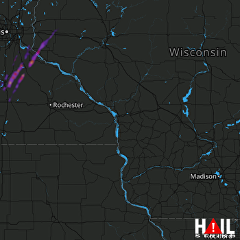 LA CROSSE (KARX) RADAR
States Impacted By Hail On April 17, 2026
Minnesota
·
Wisconsin
Counties Impacted By Hail On April 17, 2026
Blue Earth, MN
·
Dakota, MN
·
Goodhue, MN
·
Le Sueur, MN
·
Nicollet, MN
·
Rice, MN
·
Sibley, MN
·
Steele, MN
·
Waseca, MN
·
Washington, MN
·
Barron, WI
·
Pierce, WI
·
Polk, WI
·
St. Croix, WI
·
Washburn, WI
Cities Impacted By Hail On April 17, 2026
Afton, MN
·
Baldwin, WI
·
Cleveland, MN
·
Coates, MN
·
Cottage Grove, MN
·
Cumberland, WI
·
Dennison, MN
·
Dundas, MN
·
Elysian, MN
·
Faribault, MN
·
Farmington, MN
·
Hammond, WI
·
Hampton, MN
·
Hastings, MN
·
Inver Grove Heights, MN
·
Janesville, MN
·
Kasota, MN
·
Lonsdale, MN
·
Madison Lake, MN
·
Mankato, MN
·
Medford, MN
·
Miesville, MN
·
Morristown, MN
·
Nerstrand, MN
·
Northfield, MN
·
Owatonna, MN
·
Randolph, MN
·
River Falls, WI
·
Rosemount, MN
·
Shell Lake, WI
·
St. Paul Park, MN
·
St. Peter, MN
·
Warsaw, MN
Zip Codes Impacted By Hail On April 17, 2026
56096
·
56093
·
56091
·
56082
·
56078
·
56072
·
56068
·
56065
·
56063
·
56058
·
56057
·
56052
·
56050
·
56048
·
56028
·
56024
·
56017
·
56003
·
56001
·
55946
·
55089
·
55077
·
55076
·
55071
·
55068
·
55065
·
55060
·
55057
·
55053
·
55052
·
55049
·
55046
·
55033
·
55031
·
55024
·
55021
·
55019
·
55018
·
55016
·
55009
·
55001
·
54889
·
54871
·
54870
·
54829
·
54826
·
54813
·
54028
·
54023
·
54022
·
54021
·
54015
·
54013
·
54002

