This weather event on April 15, 2026 includes:
2 states
13 counties,
16 cities,
and 98 zip codes.
There were 5433 total properties that were impacted and have possible damage.
States Impacted By Hail On April 15, 2026
Connecticut
·
New York
Counties Impacted By Hail On April 15, 2026
Fairfield, CT
·
Hartford, CT
·
Litchfield, CT
·
New Haven, CT
·
Albany, NY
·
Chenango, NY
·
Columbia, NY
·
Delaware, NY
·
Dutchess, NY
·
Greene, NY
·
Putnam, NY
·
Sullivan, NY
·
Ulster, NY
Cities Impacted By Hail On April 15, 2026
Amenia, NY
·
Fleischmanns, NY
·
Hyde Park, NY
·
Margaretville, NY
·
Oakville, CT
·
Palenville, NY
·
Pawling, NY
·
Pine Hill, NY
·
Rifton, NY
·
Roscoe, NY
·
Rosendale Hamlet, NY
·
Sharon, CT
·
Tannersville, NY
·
Tillson, NY
·
Waterbury, CT
·
Watertown, CT
Zip Codes Impacted By Hail On April 15, 2026
6708
·
12122
·
12571
·
12569
·
12564
·
12563
·
12561
·
12546
·
12545
·
12533
·
12531
·
12528
·
12503
·
12501
·
12495
·
12493
·
12487
·
12486
·
12485
·
12484
·
12480
·
12477
·
12475
·
12473
·
12472
·
12471
·
12465
·
12464
·
12463
·
12461
·
12458
·
12457
·
12456
·
12455
·
12450
·
12446
·
12441
·
12436
·
12430
·
12429
·
12427
·
12492
·
12538
·
12582
·
13756
·
13733
·
13731
·
12776
·
12768
·
12765
·
12758
·
12740
·
12725
·
12601
·
12594
·
12592
·
12583
·
12578
·
12421
·
12419
·
12416
·
12414
·
12411
·
12410
·
12406
·
12404
·
12401
·
12193
·
12147
·
12120
·
12075
·
12037
·
10512
·
6812
·
6796
·
6795
·
6787
·
6786
·
6785
·
6784
·
6782
·
6779
·
6762
·
6757
·
6755
·
6716
·
6710
·
6704
·
6091
·
6073
·
6070
·
6069
·
6068
·
6039
·
6033
·
6031
·
6027
·
6002
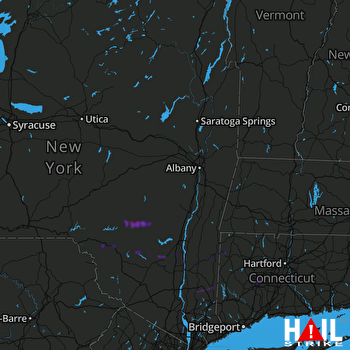 ALBANY (KENX) RADAR

