This weather event on April 15, 2026 includes:
1 states
22 counties,
15 cities,
and 55 zip codes.
There were 15818 total properties that were impacted and have possible damage.
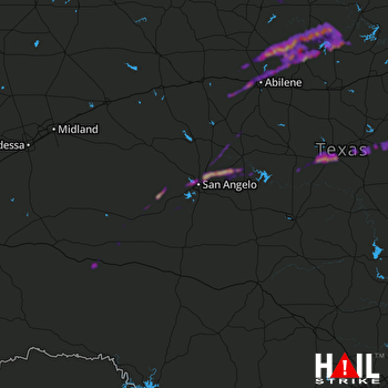 SAN ANGELO (KSJT) RADAR
States Impacted By Hail On April 15, 2026
Texas
Counties Impacted By Hail On April 15, 2026
Brown, TX
·
Callahan, TX
·
Coke, TX
·
Coleman, TX
·
Comanche, TX
·
Concho, TX
·
Crockett, TX
·
Erath, TX
·
Hamilton, TX
·
Haskell, TX
·
Irion, TX
·
Jones, TX
·
Nolan, TX
·
Reagan, TX
·
Runnels, TX
·
Shackelford, TX
·
Stephens, TX
·
Taylor, TX
·
Terrell, TX
·
Throckmorton, TX
·
Tom Green, TX
·
Young, TX
Cities Impacted By Hail On April 15, 2026
Abilene, TX
·
Albany, TX
·
Bangs, TX
·
Breckenridge, TX
·
Brownwood, TX
·
Early, TX
·
Gustine, TX
·
Impact, TX
·
Lueders, TX
·
Merkel, TX
·
Miles, TX
·
San Angelo, TX
·
Tye, TX
·
Winters, TX
·
Woodson, TX
Zip Codes Impacted By Hail On April 15, 2026
76432
·
76442
·
76531
·
79781
·
79699
·
79607
·
79606
·
79605
·
79603
·
79601
·
79567
·
79563
·
79561
·
79536
·
79533
·
79525
·
79521
·
79504
·
79503
·
79501
·
76953
·
76943
·
76941
·
76939
·
76935
·
76933
·
76930
·
76905
·
76904
·
76903
·
76901
·
76890
·
76888
·
76884
·
76882
·
76878
·
76875
·
76866
·
76865
·
76861
·
76823
·
76821
·
76802
·
76801
·
76491
·
76483
·
76464
·
76457
·
76455
·
76452
·
76446
·
76436
·
76430
·
76429
·
76424

