This weather event on April 15, 2026 includes:
2 states
20 counties,
36 cities,
and 64 zip codes.
There were 1633 total properties that were impacted and have possible damage.
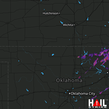 VANCE AFB (KVNX) RADAR
States Impacted By Hail On April 15, 2026
Kansas
·
Oklahoma
Counties Impacted By Hail On April 15, 2026
Chautauqua, KS
·
Montgomery, KS
·
Wilson, KS
·
Cleveland, OK
·
Kay, OK
·
Lincoln, OK
·
Logan, OK
·
McClain, OK
·
Noble, OK
·
Nowata, OK
·
Okfuskee, OK
·
Okmulgee, OK
·
Osage, OK
·
Pawnee, OK
·
Payne, OK
·
Pottawatomie, OK
·
Rogers, OK
·
Seminole, OK
·
Tulsa, OK
·
Washington, OK
Cities Impacted By Hail On April 15, 2026
Avant, OK
·
Barnsdall, OK
·
Bartlesville, OK
·
Burbank, OK
·
Caney, KS
·
Coffeyville, KS
·
Copan, OK
·
Cromwell, OK
·
Dearing, KS
·
Delaware, OK
·
Dewey, OK
·
Fairfax, OK
·
Havana, KS
·
Independence, KS
·
Lenapah, OK
·
Liberty, KS
·
McCord, OK
·
Neodesha, KS
·
Nowata, OK
·
Ochelata, OK
·
Okemah, OK
·
Okmulgee, OK
·
Pawhuska, OK
·
Perkins, OK
·
Ponca City, OK
·
Seminole, OK
·
Shidler, OK
·
Skiatook, OK
·
South Coffeyville, OK
·
Sperry, OK
·
Tonkawa, OK
·
Tulsa, OK
·
Turley, OK
·
Tyro, KS
·
Wann, OK
·
Wynona, OK
Zip Codes Impacted By Hail On April 15, 2026
74073
·
74447
·
74884
·
74881
·
74878
·
74875
·
74868
·
74859
·
74840
·
74837
·
74833
·
74653
·
74652
·
74650
·
74644
·
74641
·
74637
·
74633
·
74630
·
74604
·
74601
·
74130
·
74126
·
74084
·
74083
·
74080
·
74075
·
74074
·
74072
·
74070
·
74061
·
74059
·
74058
·
74056
·
74051
·
74048
·
74045
·
74042
·
74035
·
74032
·
74029
·
74027
·
74022
·
74006
·
74003
·
74002
·
74001
·
73095
·
73074
·
73058
·
73051
·
73027
·
67364
·
67363
·
67360
·
67355
·
67351
·
67347
·
67340
·
67337
·
67335
·
67333
·
67301
·
66757

