This weather event on April 15, 2026 includes:
2 states
17 counties,
25 cities,
and 67 zip codes.
There were 913 total properties that were impacted and have possible damage.
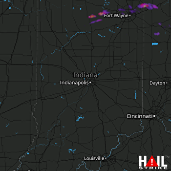 INDIANAPOLIS (KIND) RADAR
States Impacted By Hail On April 15, 2026
Indiana
·
Ohio
Counties Impacted By Hail On April 15, 2026
Allen, IN
·
Cass, IN
·
DeKalb, IN
·
Fulton, IN
·
Grant, IN
·
Kosciusko, IN
·
Miami, IN
·
Sullivan, IN
·
Wabash, IN
·
Wells, IN
·
Whitley, IN
·
Allen, OH
·
Defiance, OH
·
Mercer, OH
·
Paulding, OH
·
Putnam, OH
·
Van Wert, OH
Cities Impacted By Hail On April 15, 2026
Bluffton, IN
·
Cecil, OH
·
Churubusco, IN
·
Claypool, IN
·
Defiance, OH
·
Delphos, OH
·
Elgin, OH
·
Fort Jennings, OH
·
Fort Wayne, IN
·
Grabill, IN
·
Harlan, IN
·
Hicksville, OH
·
Huntertown, IN
·
Leo-Cedarville, IN
·
Macy, IN
·
Mexico, IN
·
Ottoville, OH
·
Pierceton, IN
·
Rochester, IN
·
Sherwood, OH
·
Sidney, IN
·
Van Buren, IN
·
Vaughnsville, OH
·
Winona Lake, IN
·
Woodburn, IN
Zip Codes Impacted By Hail On April 15, 2026
47882
·
47848
·
47838
·
46991
·
46988
·
46982
·
46975
·
46974
·
46970
·
46962
·
46958
·
46952
·
46951
·
46950
·
46910
·
46845
·
46835
·
46825
·
46818
·
46815
·
46797
·
46788
·
46787
·
46785
·
46774
·
46766
·
46765
·
46764
·
46763
·
46748
·
46743
·
46741
·
46738
·
46725
·
46723
·
46721
·
46714
·
46706
·
46590
·
46580
·
46562
·
46539
·
46510
·
45894
·
45891
·
45887
·
45882
·
45879
·
45876
·
45873
·
45863
·
45862
·
45849
·
45844
·
45838
·
45833
·
45832
·
45830
·
45827
·
45821
·
45813
·
45809
·
45807
·
43556
·
43536
·
43526
·
43512

