This weather event on April 15, 2026 includes:
3 states
17 counties,
23 cities,
and 62 zip codes.
There were total properties that were impacted and have possible damage.
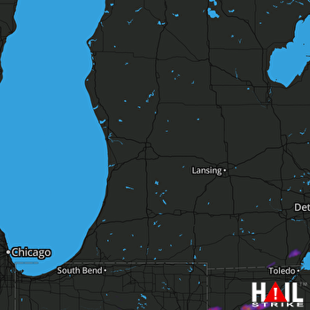 GRAND RAPIDS (KGRR) RADAR
States Impacted By Hail On April 15, 2026
Indiana
·
Michigan
·
Ohio
Counties Impacted By Hail On April 15, 2026
Allen, IN
·
Cass, IN
·
DeKalb, IN
·
Fulton, IN
·
Kosciusko, IN
·
Marshall, IN
·
Miami, IN
·
Wabash, IN
·
Whitley, IN
·
Lenawee, MI
·
Monroe, MI
·
Defiance, OH
·
Fulton, OH
·
Henry, OH
·
Paulding, OH
·
Putnam, OH
·
Wood, OH
Cities Impacted By Hail On April 15, 2026
Akron, IN
·
Belmore, OH
·
Bourbon, IN
·
Bremen, IN
·
Claypool, IN
·
Defiance, OH
·
Etna Green, IN
·
Florida, OH
·
Fulton, IN
·
Harlan, IN
·
Haskins, OH
·
Hicksville, OH
·
Holgate, OH
·
Huntertown, IN
·
Malinta, OH
·
Monroe, MI
·
North Manchester, IN
·
Perrysburg, OH
·
Pierceton, IN
·
Rochester, IN
·
Silver Lake, IN
·
South Monroe, MI
·
West Monroe, MI
Zip Codes Impacted By Hail On April 15, 2026
46988
·
43551
·
43525
·
49276
·
49270
·
49248
·
49228
·
48182
·
48161
·
48145
·
48140
·
48133
·
46982
·
46975
·
46974
·
46962
·
46951
·
46939
·
46926
·
46910
·
46845
·
46835
·
46818
·
46814
·
46797
·
46788
·
46787
·
46774
·
46765
·
46764
·
46748
·
46743
·
46741
·
46725
·
46723
·
46704
·
46580
·
46562
·
46550
·
46524
·
46510
·
46506
·
46504
·
45856
·
45821
·
45813
·
43569
·
43556
·
43545
·
43540
·
43536
·
43535
·
43534
·
43527
·
43526
·
43524
·
43523
·
43522
·
43516
·
43515
·
43512
·
43402

