This weather event on April 15, 2026 includes:
1 states
19 counties,
24 cities,
and 64 zip codes.
There were 7080 total properties that were impacted and have possible damage.
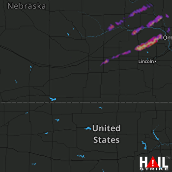 HASTINGS (KUEX) RADAR
States Impacted By Hail On April 15, 2026
Nebraska
Counties Impacted By Hail On April 15, 2026
Adams, NE
·
Buffalo, NE
·
Burt, NE
·
Butler, NE
·
Colfax, NE
·
Cuming, NE
·
Dodge, NE
·
Douglas, NE
·
Hamilton, NE
·
Kearney, NE
·
Lancaster, NE
·
Nance, NE
·
Phelps, NE
·
Platte, NE
·
Saunders, NE
·
Seward, NE
·
Stanton, NE
·
Washington, NE
·
York, NE
Cities Impacted By Hail On April 15, 2026
Bee, NE
·
Beemer, NE
·
Bellwood, NE
·
Bradshaw, NE
·
Clarkson, NE
·
Colon, NE
·
Creston, NE
·
Dwight, NE
·
Genoa, NE
·
Hooper, NE
·
Leigh, NE
·
Malmo, NE
·
Mead, NE
·
North Bend, NE
·
Platte Center, NE
·
Schuyler, NE
·
Thayer, NE
·
Ulysses, NE
·
Valparaiso, NE
·
Wahoo, NE
·
Weston, NE
·
West Point, NE
·
Winslow, NE
·
York, NE
Zip Codes Impacted By Hail On April 15, 2026
68073
·
68843
·
68982
·
68980
·
68959
·
68949
·
68944
·
68901
·
68876
·
68869
·
68841
·
68818
·
68791
·
68788
·
68716
·
68669
·
68661
·
68660
·
68659
·
68653
·
68649
·
68648
·
68647
·
68643
·
68642
·
68641
·
68640
·
68638
·
68635
·
68633
·
68632
·
68631
·
68629
·
68626
·
68624
·
68621
·
68601
·
68467
·
68460
·
68456
·
68439
·
68434
·
68371
·
68367
·
68319
·
68314
·
68070
·
68066
·
68065
·
68064
·
68061
·
68057
·
68041
·
68040
·
68036
·
68034
·
68031
·
68029
·
68025
·
68019
·
68018
·
68017
·
68007
·
68002

