This weather event on April 15, 2026 includes:
2 states
22 counties,
29 cities,
and 77 zip codes.
There were 1262 total properties that were impacted and have possible damage.
States Impacted By Hail On April 15, 2026
Kansas
·
Oklahoma
Counties Impacted By Hail On April 15, 2026
Allen, KS
·
Anderson, KS
·
Bourbon, KS
·
Butler, KS
·
Chautauqua, KS
·
Cherokee, KS
·
Coffey, KS
·
Cowley, KS
·
Crawford, KS
·
Elk, KS
·
Franklin, KS
·
Greenwood, KS
·
Labette, KS
·
Montgomery, KS
·
Neosho, KS
·
Wilson, KS
·
Woodson, KS
·
Craig, OK
·
Mayes, OK
·
Nowata, OK
·
Rogers, OK
·
Wagoner, OK
Cities Impacted By Hail On April 15, 2026
Altoona, KS
·
Benedict, KS
·
Bronson, KS
·
Buffalo, KS
·
Chanute, KS
·
Claremore, OK
·
Fair Oaks, OK
·
Fredonia, KS
·
Gas, KS
·
Gregory, OK
·
Grenola, KS
·
Howard, KS
·
Humboldt, KS
·
Justice, OK
·
LeRoy, KS
·
Mapleton, KS
·
Moline, KS
·
Moran, KS
·
Neodesha, KS
·
Parsons, KS
·
Piqua, KS
·
Princeton, KS
·
Richmond, KS
·
Rosalia, KS
·
Tiawah, OK
·
Tulsa, OK
·
Vinita, OK
·
Virgil, KS
·
Yates Center, KS
Zip Codes Impacted By Hail On April 15, 2026
66093
·
74369
·
74333
·
74332
·
74301
·
74072
·
74048
·
74042
·
74036
·
74019
·
74016
·
74015
·
74014
·
67363
·
67361
·
67357
·
67356
·
67354
·
67353
·
67352
·
67349
·
67346
·
67345
·
67344
·
67342
·
67336
·
67332
·
67301
·
67137
·
67132
·
67122
·
67074
·
67072
·
67047
·
67045
·
67042
·
67024
·
67023
·
67012
·
66871
·
66870
·
66863
·
66860
·
66857
·
66853
·
66852
·
66839
·
66783
·
66780
·
66779
·
66777
·
66776
·
66772
·
66771
·
66769
·
66761
·
66758
·
66757
·
66755
·
66754
·
66753
·
66751
·
66749
·
66748
·
66746
·
66743
·
66736
·
66732
·
66725
·
66720
·
66717
·
66716
·
66714
·
66710
·
66701
·
66080
·
66078
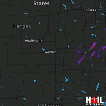 WICHITA (KICT) RADAR

