This weather event on April 14, 2026 includes:
3 states
16 counties,
20 cities,
and 50 zip codes.
There were total properties that were impacted and have possible damage.
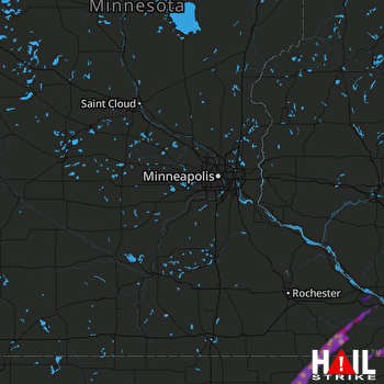 MINNEAPOLIS (KMPX) RADAR
States Impacted By Hail On April 14, 2026
Iowa
·
Minnesota
·
Wisconsin
Counties Impacted By Hail On April 14, 2026
Allamakee, IA
·
Butler, IA
·
Chickasaw, IA
·
Floyd, IA
·
Howard, IA
·
Winneshiek, IA
·
Fillmore, MN
·
Houston, MN
·
Winona, MN
·
Buffalo, WI
·
Clark, WI
·
Jackson, WI
·
La Crosse, WI
·
Monroe, WI
·
Trempealeau, WI
·
Vernon, WI
Cities Impacted By Hail On April 14, 2026
Alta Vista, IA
·
Bassett, IA
·
Black River Falls, WI
·
Charles City, IA
·
Colwell, IA
·
Eitzen, MN
·
Elma, IA
·
Genoa, WI
·
Greene, IA
·
Harmony, MN
·
Hixton, WI
·
Homer, MN
·
La Crosse, WI
·
North Washington, IA
·
Rushford, MN
·
Rushford Village, MN
·
St. Joseph, WI
·
Stoddard, WI
·
Taylor, WI
·
Winona, MN
Zip Codes Impacted By Hail On April 14, 2026
50628
·
55987
·
55974
·
55971
·
55965
·
55962
·
55954
·
55949
·
55943
·
55939
·
55931
·
55925
·
55922
·
55921
·
55919
·
54754
·
54661
·
54659
·
54658
·
54656
·
54642
·
54635
·
54632
·
54630
·
54629
·
54627
·
54623
·
54621
·
54616
·
54615
·
54611
·
54601
·
54456
·
52160
·
52155
·
52154
·
52140
·
52136
·
50659
·
50658
·
50653
·
50645
·
50636
·
50625
·
50620
·
50619
·
50616
·
50611
·
50603
·
50602

