This weather event on April 14, 2026 includes:
2 states
18 counties,
28 cities,
and 68 zip codes.
There were 696 total properties that were impacted and have possible damage.
States Impacted By Hail On April 14, 2026
Illinois
·
Indiana
Counties Impacted By Hail On April 14, 2026
Clark, IL
·
Crawford, IL
·
Cumberland, IL
·
Edgar, IL
·
Boone, IN
·
Clay, IN
·
Hancock, IN
·
Johnson, IN
·
Marion, IN
·
Montgomery, IN
·
Morgan, IN
·
Owen, IN
·
Parke, IN
·
Putnam, IN
·
Shelby, IN
·
Sullivan, IN
·
Vermillion, IN
·
Vigo, IN
Cities Impacted By Hail On April 14, 2026
Advance, IN
·
Bethany, IN
·
Blanford, IN
·
Bloomingdale, IN
·
Brazil, IN
·
Brooklyn, IN
·
Cloverdale, IN
·
Crawfordsville, IN
·
Fontanet, IN
·
Harmony, IN
·
Indianapolis city (balance), IN
·
Knightsville, IN
·
Lawrence, IN
·
Lebanon, IN
·
Marshall, IN
·
Mecca, IN
·
Montezuma, IN
·
New Palestine, IN
·
New Ross, IN
·
North Terre Haute, IN
·
Rosedale, IN
·
Seelyville, IN
·
St. Bernice, IN
·
St. Mary of the Woods, IN
·
Tecumseh, IN
·
Terre Haute, IN
·
Whitestown, IN
·
Zionsville, IN
Zip Codes Impacted By Hail On April 14, 2026
47868
·
46140
·
46075
·
46052
·
62474
·
62454
·
62433
·
62428
·
62420
·
61944
·
61924
·
47989
·
47968
·
47954
·
47952
·
47940
·
47933
·
47885
·
47882
·
47879
·
47876
·
47874
·
47872
·
47862
·
47861
·
47860
·
47859
·
47857
·
47854
·
47853
·
47849
·
47847
·
47846
·
47842
·
47840
·
47837
·
47836
·
47834
·
47833
·
47832
·
47805
·
47804
·
47803
·
47802
·
47460
·
47456
·
47433
·
46236
·
46235
·
46226
·
46216
·
46175
·
46172
·
46171
·
46163
·
46158
·
46157
·
46151
·
46147
·
46135
·
46130
·
46120
·
46111
·
46106
·
46105
·
46077
·
46071
·
46055
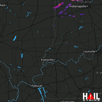 EVANSVILLE (KVWX) RADAR

