This weather event on April 14, 2026 includes:
2 states
15 counties,
26 cities,
and 47 zip codes.
There were total properties that were impacted and have possible damage.
States Impacted By Hail On April 14, 2026
Illinois
·
Indiana
Counties Impacted By Hail On April 14, 2026
Edgar, IL
·
Benton, IN
·
Boone, IN
·
Carroll, IN
·
Clay, IN
·
Jasper, IN
·
Montgomery, IN
·
Owen, IN
·
Parke, IN
·
Pulaski, IN
·
Putnam, IN
·
Tippecanoe, IN
·
Vermillion, IN
·
Vigo, IN
·
White, IN
Cities Impacted By Hail On April 14, 2026
Advance, IN
·
Americus, IN
·
Battle Ground, IN
·
Blanford, IN
·
Bloomingdale, IN
·
Brazil, IN
·
Cloverdale, IN
·
Colburn, IN
·
Crawfordsville, IN
·
Delphi, IN
·
Fontanet, IN
·
Harmony, IN
·
Ladoga, IN
·
Marshall, IN
·
Mecca, IN
·
Montezuma, IN
·
Monticello, IN
·
New Ross, IN
·
North Terre Haute, IN
·
Norway, IN
·
Rensselaer, IN
·
Reynolds, IN
·
Seelyville, IN
·
St. Bernice, IN
·
Terre Haute, IN
·
Yeoman, IN
Zip Codes Impacted By Hail On April 14, 2026
61944
·
61924
·
47997
·
47995
·
47989
·
47980
·
47978
·
47977
·
47968
·
47960
·
47959
·
47954
·
47952
·
47950
·
47946
·
47944
·
47933
·
47929
·
47923
·
47922
·
47920
·
47906
·
47905
·
47874
·
47872
·
47862
·
47860
·
47859
·
47854
·
47847
·
47846
·
47842
·
47837
·
47836
·
47834
·
47832
·
47805
·
47804
·
47803
·
47802
·
47460
·
47456
·
46923
·
46913
·
46147
·
46135
·
46120
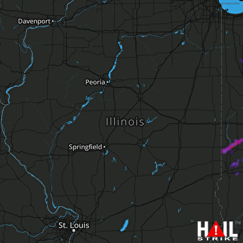 LINCOLN (KILX) RADAR

