This weather event on April 13, 2026 includes:
2 states
14 counties,
25 cities,
and 55 zip codes.
There were 1458 total properties that were impacted and have possible damage.
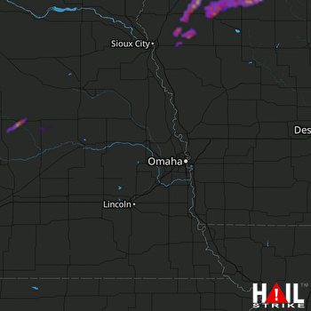 OMAHA (KOAX) RADAR
States Impacted By Hail On April 13, 2026
Iowa
·
Nebraska
Counties Impacted By Hail On April 13, 2026
Buena Vista, IA
·
Cherokee, IA
·
Clay, IA
·
Dickinson, IA
·
O'Brien, IA
·
Osceola, IA
·
Palo Alto, IA
·
Plymouth, IA
·
Pocahontas, IA
·
Sioux, IA
·
Woodbury, IA
·
Boone, NE
·
Greeley, NE
·
Platte, NE
Cities Impacted By Hail On April 13, 2026
Archer, IA
·
Ayrshire, IA
·
Calumet, IA
·
Cherokee, IA
·
Dickens, IA
·
Gillett Grove, IA
·
Greenville, IA
·
Kingsley, IA
·
Larrabee, IA
·
Linn Grove, IA
·
Marcus, IA
·
Melvin, IA
·
Meriden, IA
·
Moville, IA
·
Paullina, IA
·
Peterson, IA
·
Primghar, IA
·
Remsen, IA
·
Rossie, IA
·
Royal, IA
·
Sanborn, IA
·
Sioux Rapids, IA
·
Spalding, NE
·
Spencer, IA
·
Webb, IA
Zip Codes Impacted By Hail On April 13, 2026
51248
·
51346
·
68655
·
68842
·
68758
·
68665
·
68660
·
68644
·
68627
·
68620
·
51366
·
51358
·
51357
·
51354
·
51351
·
51350
·
51345
·
51343
·
51341
·
51338
·
51333
·
51301
·
51249
·
51245
·
51238
·
51232
·
51231
·
51201
·
51061
·
51058
·
51050
·
51049
·
51048
·
51047
·
51046
·
51039
·
51037
·
51035
·
51033
·
51031
·
51030
·
51029
·
51028
·
51024
·
51022
·
51014
·
51012
·
51009
·
51005
·
50585
·
50565
·
50554
·
50536
·
50527
·
50515

