This weather event on April 13, 2026 includes:
2 states
22 counties,
21 cities,
and 83 zip codes.
There were 1755 total properties that were impacted and have possible damage.
States Impacted By Hail On April 13, 2026
Iowa
·
Illinois
Counties Impacted By Hail On April 13, 2026
Clinton, IA
·
Des Moines, IA
·
Lee, IA
·
Louisa, IA
·
Scott, IA
·
Bureau, IL
·
Carroll, IL
·
Cass, IL
·
Hancock, IL
·
Henderson, IL
·
Henry, IL
·
Knox, IL
·
LaSalle, IL
·
Marshall, IL
·
McDonough, IL
·
Mercer, IL
·
Putnam, IL
·
Rock Island, IL
·
Schuyler, IL
·
Stark, IL
·
Warren, IL
·
Whiteside, IL
Cities Impacted By Hail On April 13, 2026
Andover, IA
·
Bradford, IL
·
Burlington, IA
·
Charlotte, IA
·
Cordova, IL
·
Coyne Center, IL
·
Donnellson, IA
·
Galva, IL
·
Henry, IL
·
Hooppole, IL
·
Keithsburg, IL
·
Keokuk, IA
·
Kewanee, IL
·
La Fayette, IL
·
Lostant, IL
·
Oquawka, IL
·
Princeton, IA
·
Prophetstown, IL
·
Toulon, IL
·
Welton, IA
·
Wenona, IL
Zip Codes Impacted By Hail On April 13, 2026
61252
·
61473
·
61540
·
62691
·
62374
·
62367
·
62358
·
62354
·
62341
·
62326
·
62321
·
62319
·
61565
·
61560
·
61537
·
61491
·
61485
·
61483
·
61480
·
61476
·
61475
·
61470
·
61469
·
61460
·
61455
·
61452
·
61449
·
61443
·
61442
·
61438
·
61437
·
61434
·
61423
·
61421
·
61420
·
61415
·
61414
·
61377
·
61376
·
61375
·
61368
·
61364
·
61361
·
61336
·
61335
·
61334
·
61327
·
61283
·
61281
·
61279
·
61277
·
61276
·
61275
·
61264
·
61261
·
61260
·
61258
·
61250
·
61243
·
61242
·
61234
·
61231
·
61230
·
52774
·
52768
·
52753
·
52751
·
52750
·
52742
·
52732
·
52731
·
52727
·
52701
·
52658
·
52656
·
52646
·
52639
·
52638
·
52632
·
52625
·
52601
·
52070
·
52037
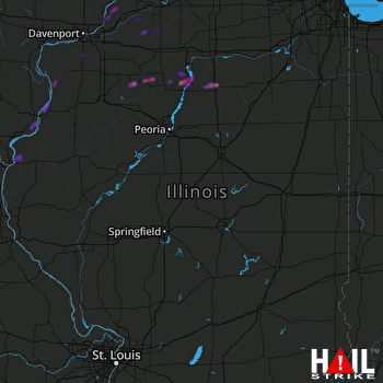 LINCOLN (KILX) RADAR

