This weather event on April 11, 2026 includes:
2 states
24 counties,
22 cities,
and 71 zip codes.
There were 4266 total properties that were impacted and have possible damage.
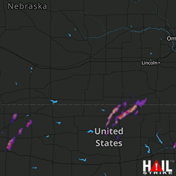 HASTINGS (KUEX) RADAR
States Impacted By Hail On April 11, 2026
Kansas
·
Nebraska
Counties Impacted By Hail On April 11, 2026
Brown, KS
·
Cloud, KS
·
Decatur, KS
·
Gove, KS
·
Graham, KS
·
Jackson, KS
·
Jewell, KS
·
Lincoln, KS
·
Mitchell, KS
·
Nemaha, KS
·
Norton, KS
·
Ottawa, KS
·
Pottawatomie, KS
·
Republic, KS
·
Riley, KS
·
Sheridan, KS
·
Thomas, KS
·
Wabaunsee, KS
·
Washington, KS
·
Frontier, NE
·
Jefferson, NE
·
Red Willow, NE
·
Saline, NE
·
Thayer, NE
Cities Impacted By Hail On April 11, 2026
Belleville, KS
·
Chester, NE
·
Courtland, KS
·
Cuba, KS
·
Endicott, NE
·
Gilead, NE
·
Goff, KS
·
Hubbell, NE
·
Jamestown, KS
·
Lenora, KS
·
Louisville, KS
·
Menlo, KS
·
Munden, KS
·
Republic, KS
·
Rexford, KS
·
Reynolds, NE
·
Sabetha, KS
·
Scottsville, KS
·
Selden, KS
·
Soldier, KS
·
Steele City, NE
·
Wamego, KS
Zip Codes Impacted By Hail On April 11, 2026
67420
·
67645
·
69034
·
69001
·
68464
·
68440
·
68375
·
68370
·
68362
·
68352
·
68350
·
68342
·
68340
·
68338
·
68327
·
68325
·
68303
·
67757
·
67753
·
67751
·
67749
·
67740
·
67738
·
67737
·
67654
·
67653
·
67650
·
67648
·
67643
·
67635
·
67629
·
67481
·
67452
·
67445
·
67436
·
67417
·
66968
·
66966
·
66964
·
66963
·
66960
·
66959
·
66958
·
66956
·
66955
·
66949
·
66948
·
66946
·
66944
·
66942
·
66940
·
66939
·
66938
·
66937
·
66935
·
66930
·
66901
·
66550
·
66547
·
66540
·
66534
·
66521
·
66515
·
66502
·
66432
·
66428
·
66425
·
66422
·
66416
·
66407
·
66401

