This weather event on April 11, 2026 includes:
3 states
23 counties,
21 cities,
and 76 zip codes.
There were 6704 total properties that were impacted and have possible damage.
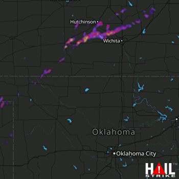 VANCE AFB (KVNX) RADAR
States Impacted By Hail On April 11, 2026
Kansas
·
Oklahoma
·
Texas
Counties Impacted By Hail On April 11, 2026
Barber, KS
·
Butler, KS
·
Chase, KS
·
Clark, KS
·
Comanche, KS
·
Harvey, KS
·
Kingman, KS
·
Marion, KS
·
McPherson, KS
·
Pratt, KS
·
Reno, KS
·
Sedgwick, KS
·
Stafford, KS
·
Beaver, OK
·
Caddo, OK
·
Canadian, OK
·
Ellis, OK
·
Grady, OK
·
Harper, OK
·
Lincoln, OK
·
Woods, OK
·
Hemphill, TX
·
Lipscomb, TX
Cities Impacted By Hail On April 11, 2026
Andale, KS
·
Bentley, KS
·
Burns, KS
·
Burrton, KS
·
Cunningham, KS
·
Darrouzett, TX
·
Follett, TX
·
Goessel, KS
·
Hutchinson, KS
·
Laverne, OK
·
Mount Hope, KS
·
Newton, KS
·
Penalosa, KS
·
Pratt, KS
·
Preston, KS
·
Pretty Prairie, KS
·
Sedgwick, KS
·
South Hutchinson, KS
·
Turon, KS
·
Union City, OK
·
Whitewater, KS
Zip Codes Impacted By Hail On April 11, 2026
67035
·
67050
·
67053
·
67056
·
67114
·
73842
·
79014
·
79034
·
79024
·
79011
·
79005
·
74079
·
73932
·
73858
·
73848
·
73843
·
73834
·
73090
·
73059
·
73036
·
73006
·
67842
·
67831
·
67583
·
67581
·
67579
·
67578
·
67576
·
67570
·
67568
·
67566
·
67561
·
67557
·
67545
·
67543
·
67530
·
67522
·
67514
·
67510
·
67505
·
67502
·
67501
·
67428
·
67155
·
67154
·
67147
·
67143
·
67135
·
67134
·
67127
·
67124
·
67123
·
67108
·
67107
·
67104
·
67071
·
67068
·
67066
·
67065
·
67063
·
67062
·
67030
·
67029
·
67028
·
67025
·
67020
·
67016
·
67001
·
66866
·
66862
·
66851
·
66850
·
66845
·
66843
·
66840
·
66801

