This weather event on April 10, 2026 includes:
2 states
23 counties,
12 cities,
and 56 zip codes.
There were total properties that were impacted and have possible damage.
States Impacted By Hail On April 10, 2026
Kansas
·
Nebraska
Counties Impacted By Hail On April 10, 2026
Clay, KS
·
Cloud, KS
·
Jewell, KS
·
Marshall, KS
·
Nemaha, KS
·
Pottawatomie, KS
·
Republic, KS
·
Riley, KS
·
Washington, KS
·
Clay, NE
·
Fillmore, NE
·
Hall, NE
·
Hamilton, NE
·
Kearney, NE
·
Lancaster, NE
·
Merrick, NE
·
Nance, NE
·
Nuckolls, NE
·
Platte, NE
·
Polk, NE
·
Saline, NE
·
Thayer, NE
·
York, NE
Cities Impacted By Hail On April 10, 2026
Carleton, NE
·
Clay Center, KS
·
Clyde, KS
·
Concordia, KS
·
Doniphan, NE
·
Grand Island, NE
·
Heartwell, NE
·
Nora, NE
·
Oak, NE
·
Palmer, KS
·
Randolph, KS
·
Superior, NE
Zip Codes Impacted By Hail On April 10, 2026
68979
·
68978
·
68975
·
68974
·
68964
·
68961
·
68945
·
68943
·
68942
·
68883
·
68865
·
68832
·
68810
·
68803
·
68801
·
68654
·
68653
·
68647
·
68642
·
68640
·
68436
·
68430
·
68372
·
68365
·
68343
·
68335
·
68326
·
68319
·
67468
·
67447
·
67432
·
67417
·
66966
·
66963
·
66962
·
66956
·
66953
·
66949
·
66948
·
66945
·
66943
·
66942
·
66940
·
66939
·
66938
·
66936
·
66935
·
66933
·
66930
·
66901
·
66554
·
66548
·
66544
·
66521
·
66508
·
66415
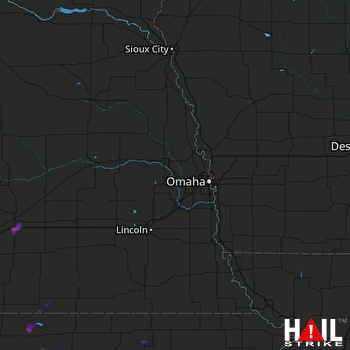 OMAHA (KOAX) RADAR

