This weather event on April 10, 2026 includes:
1 states
14 counties,
29 cities,
and 65 zip codes.
There were 10795 total properties that were impacted and have possible damage.
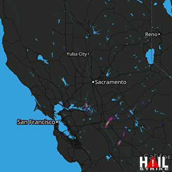 SACRAMENTO (KDAX) RADAR
States Impacted By Hail On April 10, 2026
California
Counties Impacted By Hail On April 10, 2026
Alameda, CA
·
Calaveras, CA
·
Colusa, CA
·
Contra Costa, CA
·
Glenn, CA
·
Madera, CA
·
Mariposa, CA
·
Merced, CA
·
Sacramento, CA
·
San Joaquin, CA
·
Solano, CA
·
Stanislaus, CA
·
Tuolumne, CA
·
Yolo, CA
Cities Impacted By Hail On April 10, 2026
Ballico, CA
·
Bay Point, CA
·
Bear Valley, CA
·
Bethel Island, CA
·
Blackhawk, CA
·
Camino Tassajara, CA
·
Catheys Valley, CA
·
Concord, CA
·
Courtland, CA
·
Danville, CA
·
Delhi, CA
·
Discovery Bay, CA
·
Fairfield, CA
·
Fremont, CA
·
Hilmar-Irwin, CA
·
Hughson, CA
·
Knightsen, CA
·
Lodi, CA
·
Manteca, CA
·
Maxwell, CA
·
Oakley, CA
·
Pittsburg, CA
·
Rio Vista, CA
·
Ripon, CA
·
Salida, CA
·
San Ramon, CA
·
Stevinson, CA
·
Turlock, CA
·
Union City, CA
Zip Codes Impacted By Hail On April 10, 2026
95222
·
95641
·
95987
·
95979
·
95963
·
95955
·
95932
·
95912
·
95690
·
95687
·
95620
·
95615
·
95612
·
95389
·
95386
·
95383
·
95382
·
95380
·
95374
·
95370
·
95368
·
95366
·
95361
·
95358
·
95357
·
95338
·
95337
·
95336
·
95334
·
95327
·
95326
·
95324
·
95323
·
95321
·
95320
·
95316
·
95315
·
95311
·
95306
·
95304
·
95303
·
95252
·
95248
·
95246
·
95242
·
95230
·
95219
·
95215
·
94587
·
94585
·
94582
·
94571
·
94565
·
94561
·
94552
·
94548
·
94536
·
94513
·
94512
·
94511
·
94506
·
94505
·
93653
·
93637
·
93635

