This weather event on April 9, 2026 includes:
2 states
28 counties,
16 cities,
and 78 zip codes.
There were 797 total properties that were impacted and have possible damage.
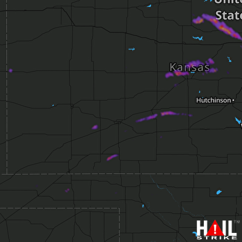 DODGE CITY (KDDC) RADAR
States Impacted By Hail On April 9, 2026
Kansas
·
Oklahoma
Counties Impacted By Hail On April 9, 2026
Barton, KS
·
Clark, KS
·
Edwards, KS
·
Ellsworth, KS
·
Ford, KS
·
Gray, KS
·
Greeley, KS
·
Hodgeman, KS
·
Kearny, KS
·
Kiowa, KS
·
Lincoln, KS
·
Meade, KS
·
Mitchell, KS
·
Morton, KS
·
Ness, KS
·
Osborne, KS
·
Ottawa, KS
·
Pawnee, KS
·
Pratt, KS
·
Rice, KS
·
Rush, KS
·
Russell, KS
·
Saline, KS
·
Stafford, KS
·
Stevens, KS
·
Beaver, OK
·
Harper, OK
·
Texas, OK
Cities Impacted By Hail On April 9, 2026
Albert, KS
·
Beverly, KS
·
Bushton, KS
·
Frederick, KS
·
Great Bend, KS
·
Greeley County unified government (balance), KS
·
Hoisington, KS
·
Holyrood, KS
·
Hunter, KS
·
Jetmore, KS
·
Lincoln Center, KS
·
Lorraine, KS
·
Odin, KS
·
Pawnee Rock, KS
·
Susank, KS
·
Tescott, KS
Zip Codes Impacted By Hail On April 9, 2026
67423
·
67576
·
67831
·
73950
·
73945
·
73942
·
73901
·
73848
·
73844
·
73842
·
73834
·
73801
·
67953
·
67951
·
67882
·
67879
·
67876
·
67869
·
67867
·
67865
·
67864
·
67860
·
67857
·
67854
·
67853
·
67844
·
67842
·
67841
·
67835
·
67834
·
67801
·
67649
·
67648
·
67634
·
67626
·
67583
·
67578
·
67575
·
67572
·
67567
·
67565
·
67564
·
67563
·
67560
·
67557
·
67554
·
67552
·
67550
·
67547
·
67544
·
67530
·
67529
·
67526
·
67525
·
67524
·
67520
·
67519
·
67511
·
67485
·
67484
·
67481
·
67473
·
67459
·
67457
·
67456
·
67455
·
67452
·
67450
·
67444
·
67439
·
67427
·
67425
·
67420
·
67418
·
67401
·
67066
·
67059
·
67054

