This weather event on April 3, 2026 includes:
3 states
20 counties,
32 cities,
and 54 zip codes.
There were total properties that were impacted and have possible damage.
States Impacted By Hail On April 3, 2026
Indiana
·
Kentucky
·
Ohio
Counties Impacted By Hail On April 3, 2026
Dearborn, IN
·
Decatur, IN
·
Fayette, IN
·
Franklin, IN
·
Jackson, IN
·
Jefferson, IN
·
Jennings, IN
·
Johnson, IN
·
Ripley, IN
·
Rush, IN
·
Shelby, IN
·
Union, IN
·
Washington, IN
·
Campbell, KY
·
Grant, KY
·
Jefferson, KY
·
Pendleton, KY
·
Butler, OH
·
Clermont, OH
·
Hamilton, OH
Cities Impacted By Hail On April 3, 2026
Alexandria, KY
·
Arlington, IN
·
Bellewood, KY
·
Brownsboro Village, KY
·
Claryville, KY
·
Country Squire Lakes, IN
·
Druid Hills, KY
·
Dry Ridge, KY
·
Fairland, IN
·
Franklin, IN
·
Glenview Manor, KY
·
Harrison, OH
·
Hills and Dales, KY
·
Holton, IN
·
Indian Hills, KY
·
Louisville, KY
·
Maryhill Estates, KY
·
Metamora, IN
·
Millhousen, IN
·
Mockingbird Valley, KY
·
New Haven, OH
·
New Whiteland, IN
·
Northfield, KY
·
Riverwood, KY
·
Rolling Fields, KY
·
Shelbyville, IN
·
Spring Valley, KY
·
St. Matthews, KY
·
Thornhill, KY
·
West Harrison, IN
·
Whiteland, IN
·
Windy Hills, KY
Zip Codes Impacted By Hail On April 3, 2026
46176
·
40207
·
47353
·
47331
·
47283
·
47274
·
47265
·
47250
·
47240
·
47231
·
47229
·
47227
·
47223
·
47220
·
47170
·
47167
·
47060
·
47041
·
47037
·
47031
·
47030
·
47025
·
47024
·
47023
·
47022
·
47018
·
47012
·
47006
·
47001
·
46184
·
46173
·
46162
·
46161
·
46144
·
46143
·
46131
·
46127
·
46126
·
46110
·
46104
·
45157
·
45153
·
45053
·
45030
·
45013
·
41097
·
41040
·
41035
·
41033
·
41007
·
41006
·
41001
·
40241
·
40222
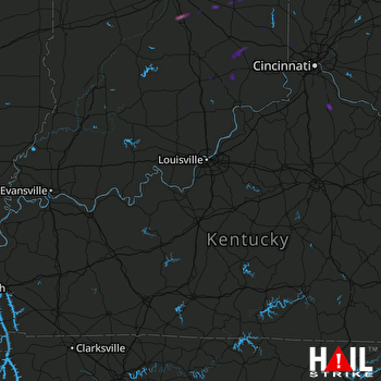 LOUISVILLE (KLVX) RADAR

