This weather event on April 2, 2026 includes:
3 states
16 counties,
23 cities,
and 70 zip codes.
There were total properties that were impacted and have possible damage.
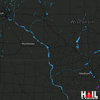 LA CROSSE (KARX) RADAR
States Impacted By Hail On April 2, 2026
Iowa
·
Illinois
·
Wisconsin
Counties Impacted By Hail On April 2, 2026
Cedar, IA
·
Clinton, IA
·
Fayette, IA
·
Carroll, IL
·
Stephenson, IL
·
Whiteside, IL
·
Winnebago, IL
·
Dane, WI
·
Dodge, WI
·
Fond du Lac, WI
·
Green, WI
·
Iowa, WI
·
Jefferson, WI
·
Lafayette, WI
·
Rock, WI
·
Walworth, WI
Cities Impacted By Hail On April 2, 2026
Calamus, IA
·
Clinton, IA
·
DeForest, WI
·
Durand, IL
·
Footville, WI
·
Fulton, IL
·
Hebron, WI
·
Horicon, WI
·
Janesville, WI
·
Juneau, WI
·
Lake Summerset, IL
·
Lowden, IA
·
Middleton, WI
·
Milton, WI
·
Mount Carroll, IL
·
Orfordville, WI
·
Stoughton, WI
·
Thomson, IL
·
Waunakee, WI
·
Welton, IA
·
Wheatland, IA
·
Whitewater, WI
·
Windsor, WI
Zip Codes Impacted By Hail On April 2, 2026
61062
·
53511
·
53039
·
52777
·
50606
·
61285
·
61270
·
61252
·
61078
·
61074
·
61072
·
61070
·
61063
·
61053
·
61046
·
61032
·
61024
·
61019
·
61014
·
53963
·
53956
·
53946
·
53933
·
53916
·
53719
·
53717
·
53705
·
53598
·
53597
·
53593
·
53589
·
53576
·
53572
·
53563
·
53562
·
53557
·
53550
·
53549
·
53548
·
53546
·
53545
·
53544
·
53538
·
53536
·
53532
·
53530
·
53520
·
53517
·
53516
·
53501
·
53190
·
53178
·
53156
·
53137
·
53118
·
53098
·
53032
·
52774
·
52772
·
52751
·
52742
·
52732
·
52731
·
52729
·
52721
·
52255
·
52254
·
52216
·
52060
·
52037

