This weather event on April 2, 2026 includes:
3 states
23 counties,
26 cities,
and 80 zip codes.
There were 122 total properties that were impacted and have possible damage.
States Impacted By Hail On April 2, 2026
Iowa
·
Illinois
·
Missouri
Counties Impacted By Hail On April 2, 2026
Lee, IA
·
Adams, IL
·
Franklin, IL
·
Fulton, IL
·
Hancock, IL
·
Henderson, IL
·
Jackson, IL
·
Knox, IL
·
Mason, IL
·
McDonough, IL
·
Peoria, IL
·
Pike, IL
·
Schuyler, IL
·
Warren, IL
·
Wayne, IL
·
Williamson, IL
·
Audrain, MO
·
Lewis, MO
·
Lincoln, MO
·
Marion, MO
·
Montgomery, MO
·
Pike, MO
·
Warren, MO
Cities Impacted By Hail On April 2, 2026
Augusta, IL
·
Bardolph, IL
·
Bowen, IL
·
Cave, MO
·
Colchester, IL
·
Dallas City, IL
·
Ellisville, IL
·
Fairview, IL
·
Farmington, IL
·
Hawk Point, MO
·
Jeffersonville, IL
·
La Grange, MO
·
Lima, IL
·
Lomax, IL
·
Loraine, IL
·
Macomb, IL
·
Marietta, IL
·
Media, IL
·
Mendon, IL
·
Middletown, MO
·
Murphysboro, IL
·
Plymouth, IL
·
Pontoosuc, IL
·
Stronghurst, IL
·
Tennessee, IL
·
West Point, IL
Zip Codes Impacted By Hail On April 2, 2026
62842
·
62380
·
62358
·
61411
·
52658
·
63471
·
63448
·
63435
·
63384
·
63383
·
63382
·
63379
·
63377
·
63359
·
63353
·
63351
·
63349
·
63343
·
63334
·
62983
·
62966
·
62932
·
62924
·
62837
·
62824
·
62823
·
62681
·
62644
·
62624
·
62446
·
62379
·
62376
·
62374
·
62373
·
62367
·
62366
·
62363
·
62351
·
62349
·
62348
·
62339
·
62330
·
62326
·
62325
·
62321
·
62320
·
62316
·
62313
·
62311
·
62305
·
61546
·
61544
·
61543
·
61542
·
61531
·
61529
·
61520
·
61501
·
61484
·
61480
·
61478
·
61477
·
61473
·
61470
·
61462
·
61460
·
61459
·
61455
·
61454
·
61450
·
61447
·
61441
·
61438
·
61432
·
61431
·
61425
·
61422
·
61418
·
61416
·
61415
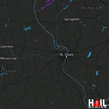 ST LOUIS (KLSX) RADAR

