This weather event on April 1, 2026 includes:
4 states
13 counties,
28 cities,
and 67 zip codes.
There were 8041 total properties that were impacted and have possible damage.
States Impacted By Hail On April 1, 2026
Delaware
·
Maryland
·
New Jersey
·
Virginia
Counties Impacted By Hail On April 1, 2026
Kent, DE
·
Sussex, DE
·
Caroline, MD
·
Dorchester, MD
·
Kent, MD
·
Queen Anne's, MD
·
St. Mary's, MD
·
Talbot, MD
·
Wicomico, MD
·
Worcester, MD
·
Atlantic, NJ
·
Cape May, NJ
·
Westmoreland, VA
Cities Impacted By Hail On April 1, 2026
Bridgeville, DE
·
California, MD
·
Chester, MD
·
Choptank, MD
·
Cordova, MD
·
Ellendale, DE
·
Estell Manor, NJ
·
Farmington, DE
·
Fruitland, MD
·
Georgetown, DE
·
Greenwood, DE
·
Harrington, DE
·
Houston, DE
·
Laurel, DE
·
Leonardtown, MD
·
Lewes, DE
·
Milford, DE
·
Millsboro, DE
·
North Cape May, NJ
·
Ocean City, MD
·
Ocean Pines, MD
·
Preston, MD
·
Rehoboth Beach, DE
·
Ridgely, MD
·
Riverview, DE
·
Salisbury, MD
·
Snow Hill, MD
·
Stevensville, MD
Zip Codes Impacted By Hail On April 1, 2026
21811
·
19958
·
19943
·
8319
·
8204
·
22520
·
21872
·
21869
·
21865
·
21863
·
21856
·
21851
·
21850
·
21849
·
21842
·
21826
·
21822
·
21813
·
21810
·
21804
·
21801
·
21673
·
21672
·
21666
·
21660
·
21657
·
21655
·
21643
·
21639
·
21632
·
21629
·
21627
·
21625
·
21622
·
21620
·
21619
·
21613
·
21601
·
20653
·
20650
·
20636
·
20634
·
20626
·
20624
·
20619
·
20618
·
20609
·
20606
·
19973
·
19971
·
19968
·
19966
·
19963
·
19960
·
19956
·
19954
·
19952
·
19951
·
19950
·
19947
·
19946
·
19941
·
19933
·
19901
·
8317
·
8270
·
8260
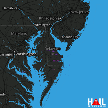 DOVER AFB (KDOX) RADAR

