This weather event on March 31, 2026 includes:
4 states
16 counties,
20 cities,
and 49 zip codes.
There were total properties that were impacted and have possible damage.
States Impacted By Hail On March 31, 2026
Iowa
·
Kansas
·
Missouri
·
Nebraska
Counties Impacted By Hail On March 31, 2026
Fremont, IA
·
Atchison, KS
·
Brown, KS
·
Doniphan, KS
·
Jackson, KS
·
Jefferson, KS
·
Nemaha, KS
·
Pottawatomie, KS
·
Andrew, MO
·
Buchanan, MO
·
Holt, MO
·
Nodaway, MO
·
Platte, MO
·
Otoe, NE
·
Pawnee, NE
·
Richardson, NE
Cities Impacted By Hail On March 31, 2026
Agency, MO
·
Atchison, KS
·
Corning, KS
·
Dawson, NE
·
De Kalb, MO
·
Effingham, KS
·
Elwood, KS
·
Goff, KS
·
Horton, KS
·
Kickapoo Site 1, KS
·
Kickapoo Site 2, KS
·
Kickapoo Site 5, KS
·
Kickapoo Site 6, KS
·
Kickapoo Site 7, KS
·
Kickapoo Tribal Center, KS
·
Nortonville, KS
·
Pawnee City, NE
·
Rushville, MO
·
St. Joseph, MO
·
Wathena, KS
Zip Codes Impacted By Hail On March 31, 2026
51648
·
64440
·
64448
·
64468
·
64506
·
66008
·
66016
·
66017
·
66023
·
66024
·
68431
·
68420
·
68410
·
68355
·
68337
·
66552
·
66550
·
66547
·
66527
·
66516
·
66509
·
66440
·
66439
·
66436
·
66434
·
66428
·
66424
·
66419
·
66417
·
66090
·
66088
·
66087
·
66060
·
66058
·
66041
·
66002
·
64507
·
64505
·
64504
·
64503
·
64501
·
64487
·
64484
·
64476
·
64446
·
64443
·
64437
·
64436
·
51640
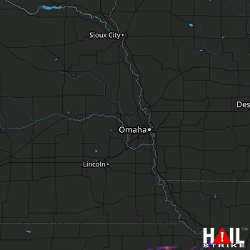 OMAHA (KOAX) RADAR

