This weather event on March 31, 2026 includes:
1 states
24 counties,
20 cities,
and 72 zip codes.
There were 898 total properties that were impacted and have possible damage.
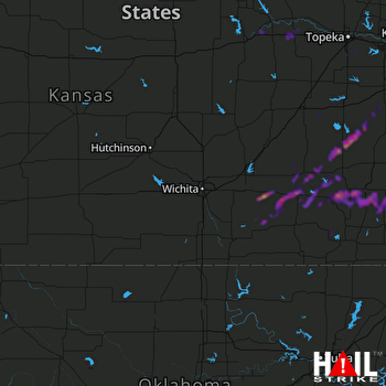 WICHITA (KICT) RADAR
States Impacted By Hail On March 31, 2026
Kansas
Counties Impacted By Hail On March 31, 2026
Allen, KS
·
Anderson, KS
·
Bourbon, KS
·
Butler, KS
·
Coffey, KS
·
Cowley, KS
·
Crawford, KS
·
Douglas, KS
·
Elk, KS
·
Franklin, KS
·
Geary, KS
·
Greenwood, KS
·
Labette, KS
·
Lyon, KS
·
Montgomery, KS
·
Neosho, KS
·
Osage, KS
·
Pottawatomie, KS
·
Riley, KS
·
Sedgwick, KS
·
Shawnee, KS
·
Wabaunsee, KS
·
Wilson, KS
·
Woodson, KS
Cities Impacted By Hail On March 31, 2026
Altoona, KS
·
Benedict, KS
·
Chanute, KS
·
Climax, KS
·
Earlton, KS
·
Elk City, KS
·
Erie, KS
·
Eureka, KS
·
Galesburg, KS
·
Harris, KS
·
Harveyville, KS
·
LeRoy, KS
·
Neosho Rapids, KS
·
New Albany, KS
·
Ogden, KS
·
Stark, KS
·
St. Paul, KS
·
Topeka, KS
·
Wakarusa, KS
·
Walnut, KS
Zip Codes Impacted By Hail On March 31, 2026
66032
·
66050
·
66078
·
66080
·
66093
·
66095
·
66401
·
66407
·
66409
·
66413
·
66414
·
66431
·
66441
·
66502
·
66503
·
66526
·
66535
·
66542
·
66546
·
66547
·
66609
·
66619
·
66710
·
66714
·
66717
·
66720
·
66733
·
66740
·
66743
·
66746
·
66748
·
66753
·
66757
·
66758
·
66771
·
66775
·
66776
·
66777
·
66780
·
66783
·
66801
·
66839
·
66852
·
66853
·
66854
·
66860
·
66863
·
66864
·
66870
·
67002
·
67008
·
67012
·
67019
·
67023
·
67037
·
67039
·
67045
·
67047
·
67072
·
67074
·
67122
·
67133
·
67137
·
67156
·
67301
·
67335
·
67344
·
67346
·
67349
·
67357
·
66857
·
66736

