This weather event on March 30, 2026 includes:
1 states
9 counties,
31 cities,
and 52 zip codes.
There were 1201 total properties that were impacted and have possible damage.
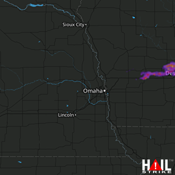 OMAHA (KOAX) RADAR
States Impacted By Hail On March 30, 2026
Iowa
Counties Impacted By Hail On March 30, 2026
Adair, IA
·
Audubon, IA
·
Boone, IA
·
Cass, IA
·
Dallas, IA
·
Guthrie, IA
·
Polk, IA
·
Pottawattamie, IA
·
Shelby, IA
Cities Impacted By Hail On March 30, 2026
Adel, IA
·
Ankeny, IA
·
Audubon, IA
·
Bouton, IA
·
Brayton, IA
·
Clive, IA
·
Dallas Center, IA
·
Des Moines, IA
·
De Soto, IA
·
Diamondhead Lake, IA
·
Exira, IA
·
Granger, IA
·
Grimes, IA
·
Guthrie Center, IA
·
Harlan, IA
·
Johnston, IA
·
Lake Panorama, IA
·
Linden, IA
·
Madrid, IA
·
Minburn, IA
·
Panora, IA
·
Perry, IA
·
Polk City, IA
·
Redfield, IA
·
Saylorville, IA
·
Urbandale, IA
·
Waukee, IA
·
West Des Moines, IA
·
Windsor Heights, IA
·
Woodward, IA
·
Yale, IA
Zip Codes Impacted By Hail On March 30, 2026
51577
·
51552
·
51537
·
51531
·
51447
·
50325
·
50324
·
50323
·
50322
·
50316
·
50314
·
50313
·
50311
·
50310
·
50277
·
50276
·
50266
·
50265
·
50263
·
50250
·
50244
·
50233
·
50226
·
50220
·
50216
·
50212
·
50167
·
50164
·
50156
·
50146
·
50131
·
50128
·
50117
·
50115
·
50111
·
50109
·
50076
·
50072
·
50070
·
50069
·
50066
·
50063
·
50048
·
50042
·
50039
·
50036
·
50025
·
50023
·
50022
·
50020
·
50003
·
50002

