This weather event on March 22, 2026 includes:
2 states
17 counties,
23 cities,
and 57 zip codes.
There were 820 total properties that were impacted and have possible damage.
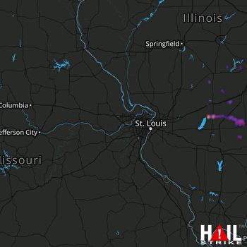 ST LOUIS (KLSX) RADAR
States Impacted By Hail On March 22, 2026
Illinois
·
Missouri
Counties Impacted By Hail On March 22, 2026
Bond, IL
·
Christian, IL
·
Clay, IL
·
Clinton, IL
·
Cumberland, IL
·
Edwards, IL
·
Effingham, IL
·
Fayette, IL
·
Franklin, IL
·
Jasper, IL
·
Marion, IL
·
Montgomery, IL
·
Moultrie, IL
·
Richland, IL
·
Shelby, IL
·
Wayne, IL
·
Perry, MO
Cities Impacted By Hail On March 22, 2026
Altamont, IL
·
Benton, IL
·
Calhoun, IL
·
Dieterich, IL
·
Farina, IL
·
Johnsonville, IL
·
Kinmundy, IL
·
Longtown, MO
·
Mulberry Grove, IL
·
Newton, IL
·
Noble, IL
·
Nokomis, IL
·
Oconee, IL
·
Olney, IL
·
Parkersburg, IL
·
Patoka, IL
·
St. Elmo, IL
·
Vandalia, IL
·
Vernon, IL
·
Wenonah, IL
·
Westervelt, IL
·
Willow Hill, IL
·
Windsor, IL
Zip Codes Impacted By Hail On March 22, 2026
61928
·
61951
·
61957
·
62075
·
62080
·
62083
·
62231
·
62253
·
62262
·
62411
·
62414
·
62418
·
62419
·
62420
·
62422
·
62424
·
62426
·
62428
·
62431
·
62434
·
62443
·
62446
·
62448
·
62450
·
62452
·
62458
·
62471
·
62475
·
62476
·
62479
·
62480
·
62553
·
62557
·
62565
·
62801
·
62807
·
62812
·
62823
·
62838
·
62839
·
62849
·
62850
·
62854
·
62858
·
62868
·
62870
·
62875
·
62880
·
62881
·
62885
·
62892
·
62895
·
62899
·
63748
·
63775
·
62824
·
62534

