This weather event on March 15, 2026 includes:
3 states
23 counties,
28 cities,
and 69 zip codes.
There were 5822 total properties that were impacted and have possible damage.
States Impacted By Hail On March 15, 2026
Arkansas
·
Missouri
·
Oklahoma
Counties Impacted By Hail On March 15, 2026
Benton, AR
·
Boone, AR
·
Crawford, AR
·
Franklin, AR
·
Madison, AR
·
Newton, AR
·
Polk, AR
·
Scott, AR
·
Sebastian, AR
·
Washington, AR
·
Barry, MO
·
Christian, MO
·
Stone, MO
·
Taney, MO
·
Adair, OK
·
Cherokee, OK
·
Delaware, OK
·
Le Flore, OK
·
McCurtain, OK
·
McIntosh, OK
·
Muskogee, OK
·
Pushmataha, OK
·
Sequoyah, OK
Cities Impacted By Hail On March 15, 2026
Branson West, MO
·
Chewey, OK
·
Dry Creek, OK
·
Duchess Landing, OK
·
Farmington, AR
·
Fayetteville, AR
·
Fort Smith, AR
·
Indian Point, MO
·
Johnson, AR
·
Kimberling City, MO
·
Moffett, OK
·
Mulberry, OK
·
Old Green, OK
·
Pettit, OK
·
Reeds Spring, MO
·
Rocky Mountain, OK
·
Shady Grove, OK
·
Shell Knob, MO
·
Siloam Springs, AR
·
Springdale, AR
·
Tenkiller, OK
·
Tontitown, AR
·
Warner, OK
·
Webbers Falls, OK
·
Welling, OK
·
West Siloam Springs, OK
·
Westville, OK
·
Whitesboro, OK
Zip Codes Impacted By Hail On March 15, 2026
65616
·
65624
·
65625
·
65630
·
65647
·
65656
·
65658
·
65681
·
65686
·
65734
·
65737
·
65747
·
65754
·
65771
·
71953
·
72601
·
72624
·
72641
·
72648
·
72670
·
72703
·
72704
·
72727
·
72730
·
72734
·
72744
·
72745
·
72753
·
72760
·
72761
·
72762
·
72764
·
72769
·
72904
·
72926
·
72959
·
74338
·
74423
·
74426
·
74427
·
74435
·
74451
·
74455
·
74457
·
74464
·
74469
·
74470
·
74471
·
74536
·
74549
·
74558
·
74562
·
74567
·
74571
·
74577
·
74728
·
74766
·
74901
·
74937
·
74939
·
74946
·
74948
·
74949
·
74954
·
74960
·
74966
·
74965
·
74931
·
72721
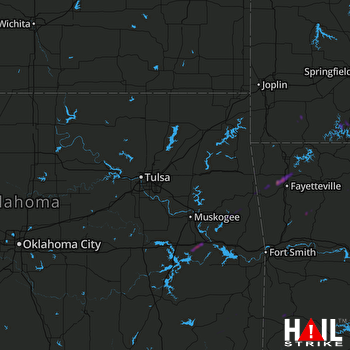 TULSA (KINX) RADAR

