This weather event on March 10, 2026 includes:
4 states
22 counties,
18 cities,
and 70 zip codes.
There were 40 total properties that were impacted and have possible damage.
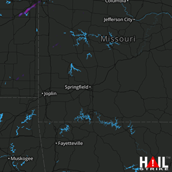 SPRINGFIELD (KSGF) RADAR
States Impacted By Hail On March 10, 2026
Arkansas
·
Kansas
·
Missouri
·
Oklahoma
Counties Impacted By Hail On March 10, 2026
Crawford, AR
·
Crawford, KS
·
Douglas, KS
·
Franklin, KS
·
Johnson, KS
·
Labette, KS
·
Miami, KS
·
Neosho, KS
·
Bates, MO
·
Carroll, MO
·
Cass, MO
·
Cedar, MO
·
Clay, MO
·
Henry, MO
·
Jackson, MO
·
Johnson, MO
·
Lafayette, MO
·
Pettis, MO
·
Ray, MO
·
St. Clair, MO
·
Vernon, MO
·
Mayes, OK
Cities Impacted By Hail On March 10, 2026
Blue Springs, MO
·
Edgerton, KS
·
Gardner, KS
·
Independence, MO
·
Kansas City, MO
·
Leawood, KS
·
Lee's Summit, MO
·
Lexington, MO
·
Loch Lloyd, MO
·
Oak Grove, MO
·
Olathe, KS
·
Overland Park, KS
·
Parsons, KS
·
Schell City, MO
·
Sedalia, MO
·
Spring Hill, KS
·
Wellington, MO
·
Wellsville, KS
Zip Codes Impacted By Hail On March 10, 2026
64011
·
64012
·
64015
·
64035
·
64036
·
64037
·
64055
·
64057
·
64061
·
64064
·
64067
·
64070
·
64074
·
64075
·
64077
·
64080
·
64081
·
64082
·
64085
·
64097
·
64114
·
64131
·
64132
·
64137
·
64145
·
64192
·
64668
·
64724
·
64730
·
64735
·
64740
·
64756
·
64770
·
64778
·
64779
·
64780
·
64783
·
65301
·
65332
·
65337
·
66013
·
66021
·
66030
·
66031
·
66061
·
66067
·
66071
·
66083
·
66085
·
66092
·
66206
·
66207
·
66210
·
66211
·
66212
·
66213
·
66221
·
66223
·
66224
·
66743
·
66753
·
66771
·
67357
·
72946
·
72959
·
74330
·
74361
·
66209
·
66062
·
64063

